File:How satellite radar altimetry works (16980176380).jpg
Jump to navigation
Jump to search
Size of this preview: 797 × 600 pixels. Other resolutions: 319 × 240 pixels | 638 × 480 pixels | 904 × 680 pixels.
Original file (904 × 680 pixels, file size: 168 KB, MIME type: image/jpeg)
Captions
Captions
Add a one-line explanation of what this file represents
Summary
[edit].jpg&action=edit§ion=1)
| Description |
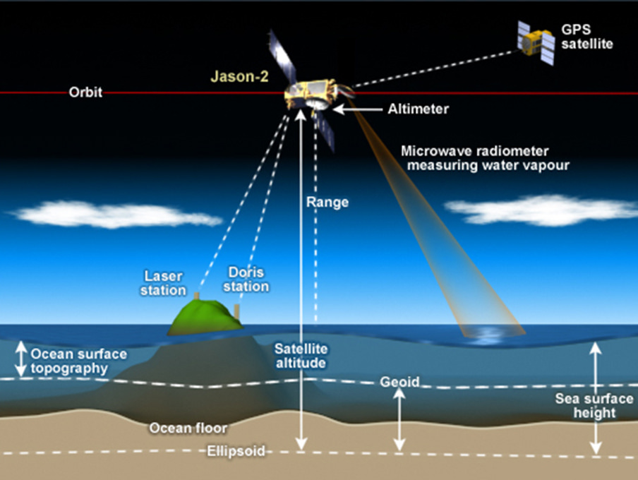
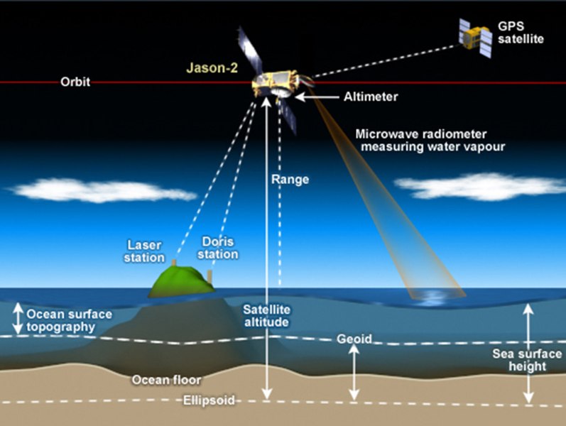
How satellite radar altimetry works Satellite radar altimeters measure the ocean surface height (sea level) by measuring the time it takes a radar pulse to make a round-trip from the satellite to the sea surface and back.
|
| Date | |
| Source | How satellite radar altimetry works |
| Author | NOAA Satellites |
Licensing
[edit].jpg&action=edit§ion=2)
This image is in the public domain because it contains materials that originally came from the U.S. National Oceanic and Atmospheric Administration, taken or made as part of an employee's official duties.
|
| This image, originally posted to Flickr, was reviewed on 2 August 2016 by the administrator or reviewer Amitie 10g, who confirmed that it was available on Flickr under the stated license on that date. |
File history
Click on a date/time to view the file as it appeared at that time.
| Date/Time | Thumbnail | Dimensions | User | Comment | |
|---|---|---|---|---|---|
| current | 12:24, 17 July 2016 | | 904 × 680 (168 KB) | Pline (talk | contribs) | Transferred from Flickr via Flickr2Commons |
You cannot overwrite this file.
File usage on Commons
The following page uses this file:
.jpg&oldid=888295118)