File:HotSpringsAR AntiqueMap 1888.jpg
Jump to navigation
Jump to search

Size of this preview: 800 × 487 pixels. Other resolutions: 320 × 195 pixels | 640 × 389 pixels | 1,024 × 623 pixels | 1,280 × 779 pixels | 2,560 × 1,557 pixels | 8,416 × 5,120 pixels.
Original file (8,416 × 5,120 pixels, file size: 7.26 MB, MIME type: image/jpeg)
Captions
Captions
Add a one-line explanation of what this file represents
Summary
[edit]
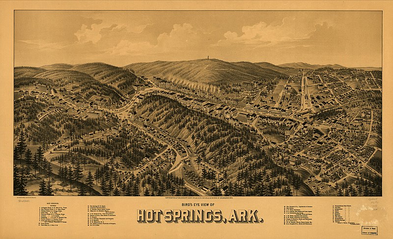
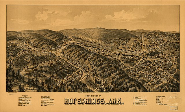
| Description | Antique panoramic map of Hot Springs, Arkansas, United States. |
| Date | circa 1888 |
| Source | https://www.flickr.com/photos/terraprints/5011161086/ |
| Author | Henry Wellge & Co. in MilWaukee, Wisconsin, United States. Uploaded onto Flickr by Roland Clark from Guam, United States, on September 21, 2010 16:45, under CC-BY-2.0 license. |
| Camera location | | View this and other nearby images on: OpenStreetMap |
|---|
Licensing
[edit]
This media file is in the public domain in the United States. This applies to U.S. works where the copyright has expired, often because its first publication occurred prior to January 1, 1929, and if not then due to lack of notice or renewal. See this page for further explanation.
|
 | |
 |
If the above is not applicable in your county/region, then
This file is licensed under the Creative Commons Attribution 2.0 Generic license.
- You are free:
- to share – to copy, distribute and transmit the work
- to remix – to adapt the work
- Under the following conditions:
- attribution – You must give appropriate credit, provide a link to the license, and indicate if changes were made. You may do so in any reasonable manner, but not in any way that suggests the licensor endorses you or your use.
| This image was originally posted to Flickr by terraprints at https://www.flickr.com/photos/50411728@N00/5011161086. It was reviewed on 17 February 2011 by FlickreviewR and was confirmed to be licensed under the terms of the cc-by-2.0. |
File history
Click on a date/time to view the file as it appeared at that time.
| Date/Time | Thumbnail | Dimensions | User | Comment | |
|---|---|---|---|---|---|
| current | 14:59, 17 February 2011 | | 8,416 × 5,120 (7.26 MB) | Yassie (talk | contribs) | {{Information |Description= Antique panoramic map of Hot Springs, Arkansas, United States. |Source= http://www.flickr.com/photos/terraprints/5011161086/ |Date= circa 1888 |Author= Henry Wellge & Co. in MilWaukee, Wisconsin, United States. Uploaded by [htt |
You cannot overwrite this file.
File usage on Commons
There are no pages that use this file.
File usage on other wikis
The following other wikis use this file:
- Usage on ja.wikipedia.org