File:Horley 1st railway station (site), Surrey (geograph 4731060).jpg
Jump to navigation
Jump to search
Size of this preview: 800 × 572 pixels. Other resolutions: 320 × 229 pixels | 640 × 457 pixels | 1,024 × 732 pixels | 1,280 × 914 pixels | 1,600 × 1,143 pixels.
Original file (1,600 × 1,143 pixels, file size: 311 KB, MIME type: image/jpeg)
Captions
Captions
Add a one-line explanation of what this file represents
Summary
[edit],_Surrey_(geograph_4731060).jpg&action=edit§ion=1)
| Description |
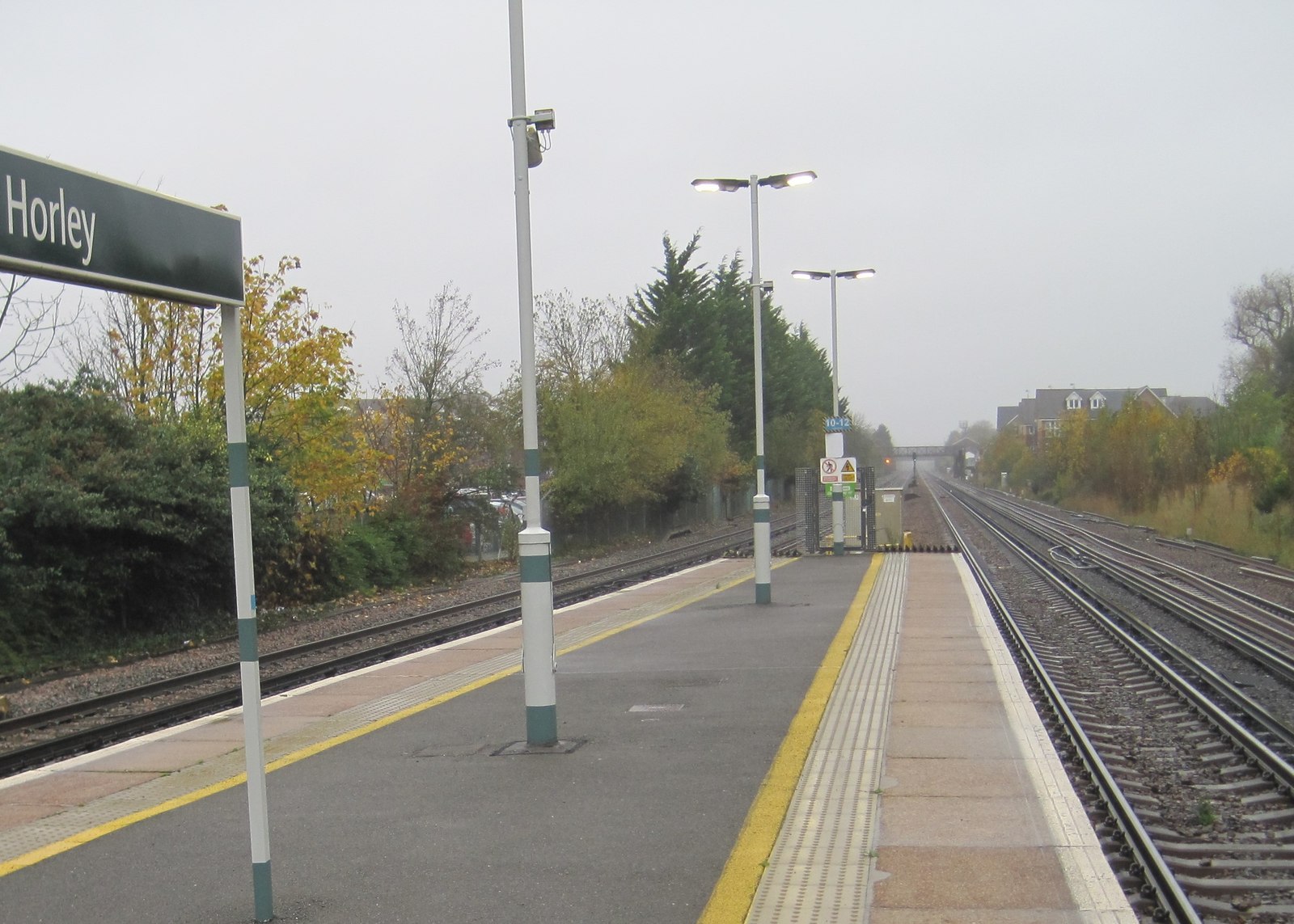
English: Horley 1st railway station (site), Surrey Opened in 1841 by the London & Brighton Railway, soon to become the London Brighton & South Coast Railway, on the line from Croydon to Three Bridges, this station closed in 1906 when it was replaced by the current one, around 300m to the south. View north towards Salfords and Croydon from the end of the current station's platform. Hidden behind the trees to the left, the former goods shed is still extant. |
| Date | |
| Source | From geograph.org.uk |
| Author | Nigel Thompson |
| Permission (Reusing this file) |
Creative Commons Attribution Share-alike license 2.0 |
| Attribution (required by the license) | Nigel Thompson / Horley 1st railway station (site), Surrey / |
| Camera location | | View this and other nearby images on: OpenStreetMap |
|---|
,_Surrey_(geograph_4731060).jpg¶ms=051.169260_N_-000.161106_E_globe:Earth_type:camera_source:geograph-osgb36(TQ28664272)_heading:0.00&language=en)
| Object location | | View this and other nearby images on: OpenStreetMap |
|---|
,_Surrey_(geograph_4731060).jpg¶ms=051.170250_N_-000.160920_E_globe:Earth_class:object_type:object_source:geograph-osgb36(TQ28674283)_heading:0.00&language=en)
Licensing
[edit],_Surrey_(geograph_4731060).jpg&action=edit§ion=2)

|
This image was taken from the Geograph project collection. See this photograph's page on the Geograph website for the photographer's contact details. The copyright on this image is owned by Nigel Thompson and is licensed for reuse under the Creative Commons Attribution-ShareAlike 2.0 license.
|
This file is licensed under the Creative Commons Attribution-Share Alike 2.0 Generic license.
Attribution: Nigel Thompson
- You are free:
- to share – to copy, distribute and transmit the work
- to remix – to adapt the work
- Under the following conditions:
- attribution – You must give appropriate credit, provide a link to the license, and indicate if changes were made. You may do so in any reasonable manner, but not in any way that suggests the licensor endorses you or your use.
- share alike – If you remix, transform, or build upon the material, you must distribute your contributions under the same or compatible license as the original.
File history
Click on a date/time to view the file as it appeared at that time.
| Date/Time | Thumbnail | Dimensions | User | Comment | |
|---|---|---|---|---|---|
| current | 11:15, 23 December 2019 | | 1,600 × 1,143 (311 KB) | Lamberhurst (talk | contribs) | Transferred from geograph.co.uk using [https://tools.wmflabs.org/geograph2commons/ geograph2commons] |
You cannot overwrite this file.
File usage on Commons
The following page uses this file:
,_Surrey_(geograph_4731060).jpg&oldid=789671640)