File:Hopsten Hoersteler Strasse 18 Bildstock 01.JPG
Jump to navigation
Jump to search
Size of this preview: 315 × 598 pixels. Other resolutions: 126 × 240 pixels | 253 × 480 pixels | 404 × 768 pixels | 539 × 1,024 pixels | 1,078 × 2,048 pixels | 2,844 × 5,401 pixels.
Original file (2,844 × 5,401 pixels, file size: 11.99 MB, MIME type: image/jpeg)
Captions
Captions
Add a one-line explanation of what this file represents
Summary
[edit]
| Description |
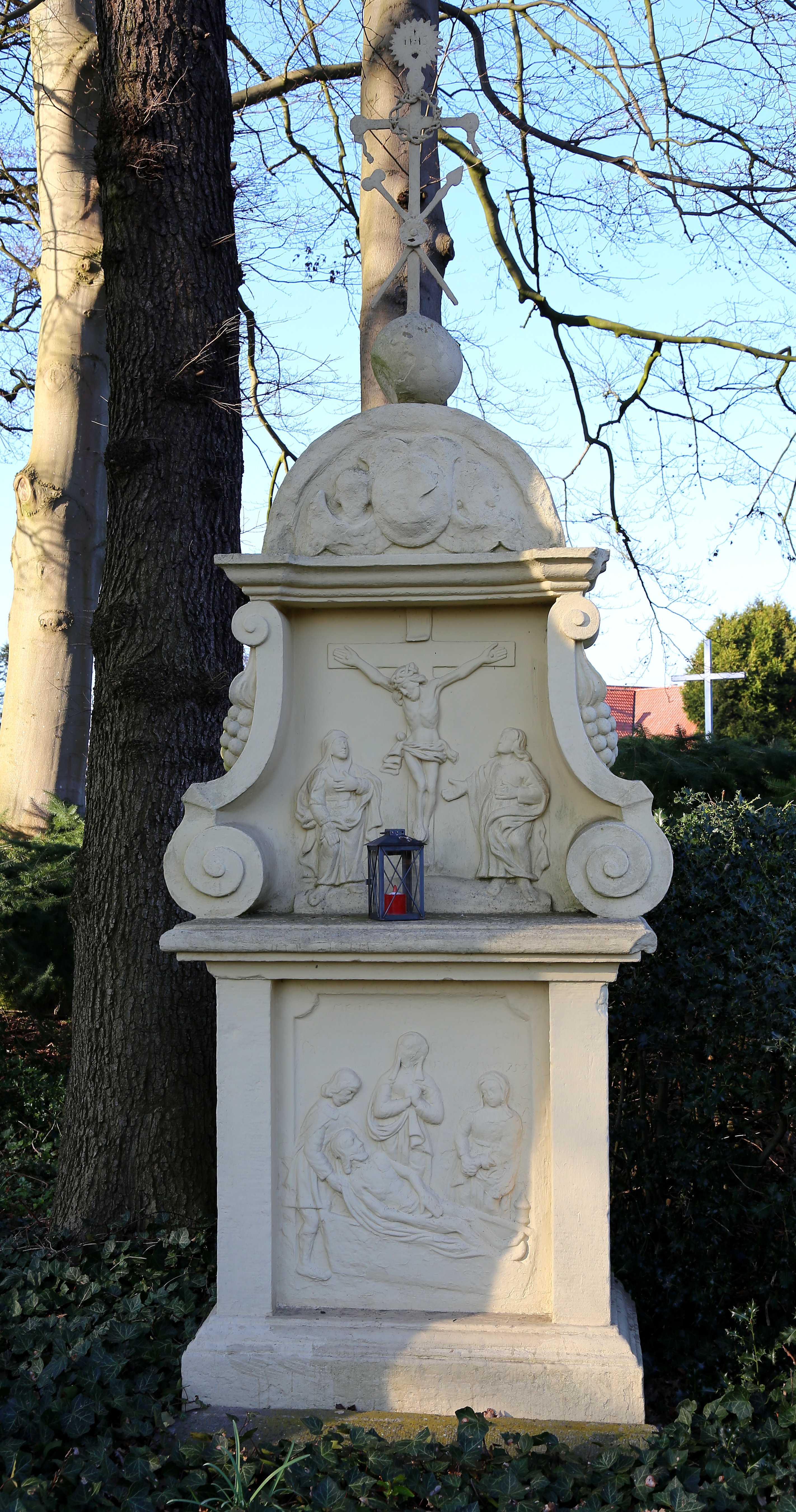
English: Wayside shrine beside 18 Hörstel Street (Hörsteler Straße 18) in Hopsten, Kreis Steinfurt, North Rhine-Westphalia, Germany. It is a listed cultural heritage monument.
Deutsch: Barocker Bildstock beim Hof Eying, Hörsteler Straße 18 in Hopsten, Kreis Steinfurt, Nordrhein-Westfalen, Deutschland. Das sakrale Denkmal steht seit 2011 unter Denkmalschutz.
This is a photograph of an architectural monument. It is on the list of cultural monuments of Hopsten, no. 46. |
| Date | |
| Source | Own work |
| Author | J.-H. Janßen |
| Camera location | | View this and other nearby images on: OpenStreetMap |
|---|
Licensing
[edit]
This file is licensed under the Creative Commons Attribution-Share Alike 4.0 International license.
- You are free:
- to share – to copy, distribute and transmit the work
- to remix – to adapt the work
- Under the following conditions:
- attribution – You must give appropriate credit, provide a link to the license, and indicate if changes were made. You may do so in any reasonable manner, but not in any way that suggests the licensor endorses you or your use.
- share alike – If you remix, transform, or build upon the material, you must distribute your contributions under the same or compatible license as the original.
File history
Click on a date/time to view the file as it appeared at that time.
| Date/Time | Thumbnail | Dimensions | User | Comment | |
|---|---|---|---|---|---|
| current | 20:29, 26 June 2016 | | 2,844 × 5,401 (11.99 MB) | J.-H. Janßen (talk | contribs) | {{Information |Description ={{en|1=Wayside shrine beside 18 Hörstel Street (''Hörsteler Straße 18'') in Hopsten, Kreis Steinfurt, North Rhine-Westphalia, Germany. It is a listed cultural heritage monument.}} {{de|1=Barocker Bildst... |
You cannot overwrite this file.
File usage on Commons
There are no pages that use this file.
File usage on other wikis
The following other wikis use this file:
- Usage on de.wikipedia.org