File:Honnavalli 1877.jpg
Jump to navigation
Jump to search

Size of this preview: 431 × 599 pixels. Other resolutions: 172 × 240 pixels | 345 × 480 pixels | 552 × 768 pixels | 736 × 1,024 pixels | 1,473 × 2,048 pixels | 2,766 × 3,846 pixels.
Original file (2,766 × 3,846 pixels, file size: 5.76 MB, MIME type: image/jpeg)
Captions
Captions
Add a one-line explanation of what this file represents
Summary
[edit]
| Description |
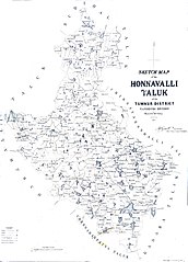
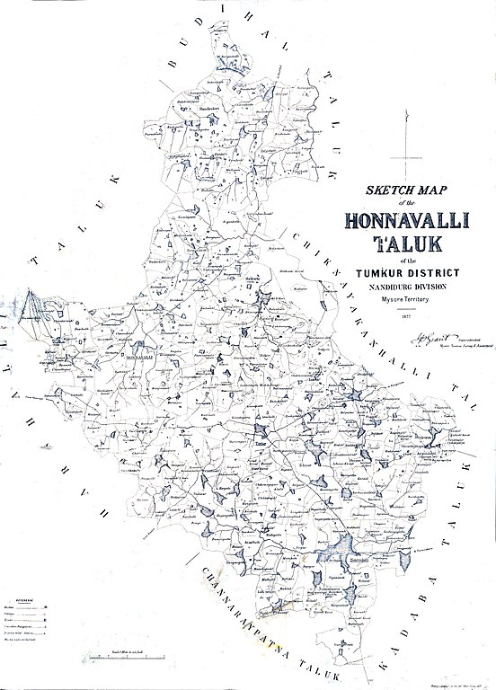
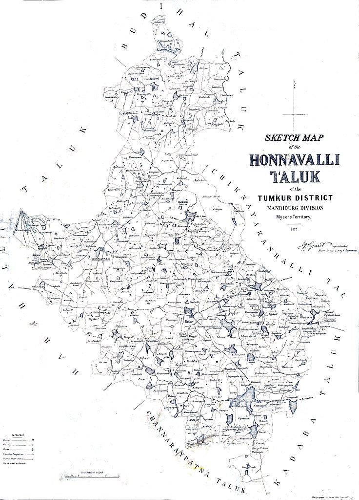
Sketch map of the Honnavalli Taluk of the Tumkur District, Nandidurg Division, Mysore Territory. 1877 |
|||||||||
| Date | ||||||||||
| Source | Survey of India. Mysore Revenue Surveys. | |||||||||
| Creator |
Government of India. Survey of India. |
|||||||||
| Permission (Reusing this file) |
|
|||||||||
| Geotemporal data | ||||||||||
| Bounding box |
|
|||||||||
| Georeferencing | ||||||||||
File history
Click on a date/time to view the file as it appeared at that time.
| Date/Time | Thumbnail | Dimensions | User | Comment | |
|---|---|---|---|---|---|
| current | 12:50, 3 July 2020 | | 2,766 × 3,846 (5.76 MB) | Shyamal (talk | contribs) | {{Map |Description=Sketch map of the Honnavalli Taluk of the Tumkur District, Nandidurg Division, Mysore Territory. 1877 |Source=Survey of India. Mysore Revenue Surveys. |Date=1877 |Author=Government of India. Survey of India. |Permission={{PD-1923}} |other_versions= }} Category:Maps of Tumkur district |
You cannot overwrite this file.
File usage on Commons
There are no pages that use this file.