File:Hong Kong Railway Route Map blank.svg
Jump to navigation
Jump to search

Size of this PNG preview of this SVG file: 655 × 599 pixels. Other resolutions: 262 × 240 pixels | 525 × 480 pixels | 839 × 768 pixels | 1,119 × 1,024 pixels | 2,238 × 2,048 pixels | 1,038 × 950 pixels.
Original file (SVG file, nominally 1,038 × 950 pixels, file size: 23 KB)
Captions
Captions
Add a one-line explanation of what this file represents
Summary
[edit]
| Description |
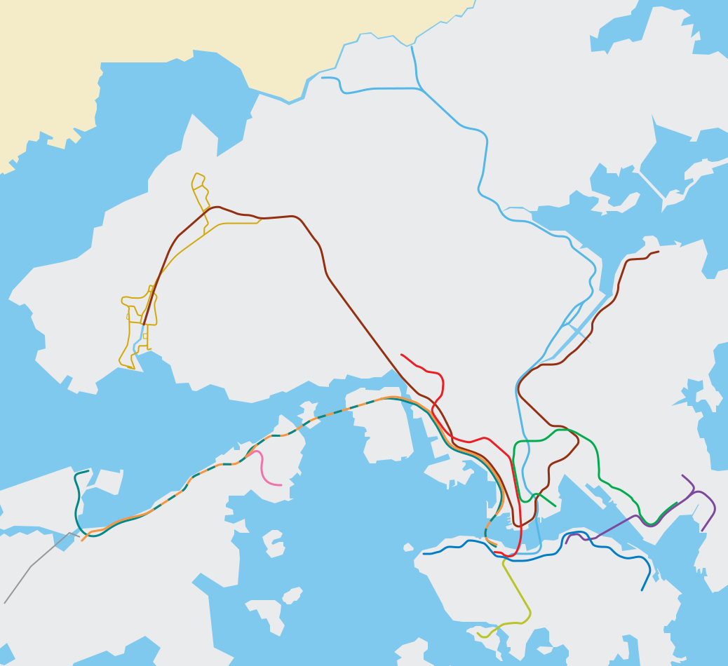
English: Blank svg route map for MTR (EN), the Hong Kong metro/subway system. It does not mean to be wholly accurate but offers a roughly geographical sense of Hong Kong territories and the MTR system. |
||
| SVG development | This map was created with Adobe Illustrator. |
||
| Date | |||
| Source | Edited based on File:Hong Kong Railway Route Map en.svg | ||
| Creator |
Peterwhy, based on works by Sameboat; File:ISL ga map.png, File:TWL ga map.png, File:KTL ga map.png, File:LAR ga map.png |
||
| Permission (Reusing this file) |
|
||
| Georeferencing | If inappropriate please set warp_status = skip to hide. | ||
| Other versions | File:Hong Kong Railway Route Map en.svg, File:Hong Kong Railway Route Map zh.svg, File:Hong Kong Railway Route Map de.svg, File:Hong Kong Railway Route Map 2007 en.svg, File:Hong Kong MTR Route Map 2007 en.svg |
File history
Click on a date/time to view the file as it appeared at that time.
| Date/Time | Thumbnail | Dimensions | User | Comment | |
|---|---|---|---|---|---|
| current | 01:02, 15 May 2022 | | 1,038 × 950 (23 KB) | Jc86035 (talk | contribs) | East Rail Line cross-harbour extension |
| 08:29, 29 June 2021 |  | 1,038 × 950 (23 KB) | Sameboat (talk | contribs) | Tuen Ma Line and Airport island expansion | |
| 00:07, 21 June 2020 |  | 1,038 × 950 (23 KB) | Sameboat (talk | contribs) | Tuen Ma line | |
| 14:12, 31 December 2016 |  | 1,038 × 950 (22 KB) | Jc86035 (talk | contribs) | line colours | |
| 10:14, 29 December 2016 |  | 1,038 × 950 (22 KB) | Jc86035 (talk | contribs) | fixed | |
| 13:45, 28 December 2016 |  | 1,038 × 950 (25 KB) | Nv7801 (talk | contribs) | Added South Island Line | |
| 06:02, 29 October 2016 |  | 1,038 × 950 (22 KB) | Jc86035 (talk | contribs) | KTE moved 2px | |
| 04:52, 29 October 2016 |  | 1,038 × 950 (22 KB) | Jc86035 (talk | contribs) | m | |
| 04:49, 29 October 2016 |  | 1,038 × 950 (22 KB) | Jc86035 (talk | contribs) | m | |
| 04:42, 29 October 2016 |  | 1,038 × 950 (22 KB) | Jc86035 (talk | contribs) | again |
You cannot overwrite this file.
File usage on Commons
The following 25 pages use this file:
- User:Chumwa/OgreBot/Potential transport maps/2016 December 21-31
- User:Chumwa/OgreBot/Potential transport maps/2016 June 1-10
- User:Chumwa/OgreBot/Potential transport maps/2016 October 21-31
- User:Chumwa/OgreBot/Public transport information/2016 December 21-31
- User:Chumwa/OgreBot/Public transport information/2016 June 1-10
- User:Chumwa/OgreBot/Public transport information/2016 October 21-31
- User:Chumwa/OgreBot/Public transport information/2020 June 21-30
- User:Chumwa/OgreBot/Public transport information/2021 June 21-30
- User:Chumwa/OgreBot/Public transport information/2022 May 11-20
- User:Chumwa/OgreBot/Transport Maps/2016 December 21-31
- User:Chumwa/OgreBot/Transport Maps/2016 June 1-10
- User:Chumwa/OgreBot/Transport Maps/2016 October 21-31
- User:Chumwa/OgreBot/Transport Maps/2020 June 21-30
- User:Chumwa/OgreBot/Transport Maps/2021 June 21-30
- User:Chumwa/OgreBot/Transport Maps/2022 May 11-20
- User:Chumwa/OgreBot/Travel and communication maps/2016 December 21-31
- User:Chumwa/OgreBot/Travel and communication maps/2016 June 1-10
- User:Chumwa/OgreBot/Travel and communication maps/2016 October 21-31
- User:OgreBot/Watercraft/2016 December 28
- User:OgreBot/Watercraft/2016 December 29
- User:OgreBot/Watercraft/2016 December 31
- User:OgreBot/Watercraft/2016 June 6-10
- User:OgreBot/Watercraft/2016 October 28
- User:OgreBot/Watercraft/2016 October 29
- File:Hong Kong Railway Route Map zh-hant.svg
File usage on other wikis
The following other wikis use this file:
- Usage on ar.wikipedia.org
- Usage on as.wikipedia.org
- Usage on az.wikipedia.org
- Usage on bh.wikipedia.org
- Usage on ca.wikipedia.org
- Usage on ceb.wikipedia.org
- Usage on cs.wikipedia.org
- Usage on da.wikipedia.org
- Usage on diq.wikipedia.org
- Usage on en.wikipedia.org
- Yuen Long station
- Tsuen Wan West station
- Kam Sheung Road station
- Tsuen Wan station
- Mei Foo station
- Lai King station
- Lai Chi Kok station
- Cheung Sha Wan station
- Sham Shui Po station
- Kwai Fong station
- Tai Wo Hau station
- Kwai Hing station
- Prince Edward station
- Mong Kok station
- Yau Ma Tei station
- University station (MTR)
- Tuen Mun station
- Siu Hong station
- Tin Shui Wai station
- Long Ping station
- Nam Cheong station
- Po Lam station
- Hang Hau station
- Tseung Kwan O station
- Tiu Keng Leng station
- Sunny Bay station
- Tai Po Market station
- Hong Kong Railway Museum
- Central station (MTR)
- East Tsim Sha Tsui station
- Tsing Yi station
- Admiralty station (MTR)
- Diamond Hill station
View more global usage of this file.