File:Holy Roman Empire 1648-es.svg
Jump to navigation
Jump to search

Size of this PNG preview of this SVG file: 756 × 599 pixels. Other resolutions: 303 × 240 pixels | 606 × 480 pixels | 969 × 768 pixels | 1,280 × 1,015 pixels | 2,560 × 2,030 pixels | 2,283 × 1,810 pixels.
Original file (SVG file, nominally 2,283 × 1,810 pixels, file size: 6.65 MB)
Captions
Captions
Add a one-line explanation of what this file represents
| Description |
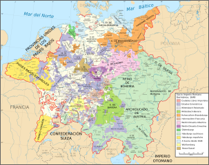
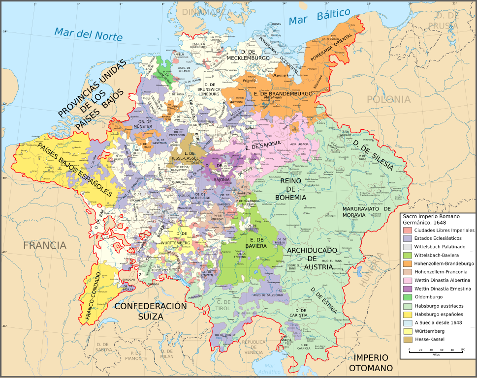
English: Map of the Holy Roman Empire in 1648, after the Peace of Westphalia which ended the Thirty Years' War.
Español: Mapa del Sacro Imperio Romano Germánico en 1648, después de la Paz de Westfalia con la que terminó la Guerra de los Treinta Años.
Territorios Suecos después de 1648
|
||||||||
| Date | |||||||||
| Source |
Las fuentes han sido tomadas de mapa de dominio público "Europa Central hacia 1648" proveniente del Atlas Histórico de William R. Shepherd, en la Perry-Castañeda Library Colección de Mapas de la Universidad de Texas. Más información obtenida de Richard Overy, 2006, The Times Complete history of the world, Times Books, ISBN 0007181299, y de este mapa Véanse también otros mapas en estos enlaces externos:
This W3C-unspecified vector image was created with Inkscape . |
||||||||
| Author | Astrokey44 / Translator:Molorco | ||||||||
| Permission (Reusing this file) |
|
||||||||
| Other versions |
[]
|


|
This SVG file contains embedded text that can be translated into your language, using any capable SVG editor, text editor or the SVG Translate tool. For more information see: About translating SVG files. |
File history
Click on a date/time to view the file as it appeared at that time.
| Date/Time | Thumbnail | Dimensions | User | Comment | |
|---|---|---|---|---|---|
| current | 08:44, 11 June 2018 | | 2,283 × 1,810 (6.65 MB) | Rowanwindwhistler (talk | contribs) | Slight colour changes. Fake text added |
| 18:39, 28 December 2007 |  | 2,283 × 1,810 (4.2 MB) | Molorco (talk | contribs) | {{Information |Description= {{en|Map of the Holy Roman Empire in 1648, after the Peace of Westphalia which ended the Thirty Years' War.}} {{es|Mapa del [[ |
You cannot overwrite this file.
File usage on Commons
The following 7 pages use this file:
File usage on other wikis
The following other wikis use this file:
- Usage on ast.wikipedia.org
- Usage on ca.wikipedia.org
- Usage on es.wikipedia.org
- Alemania
- Paz de Westfalia
- Sacro Imperio Romano Germánico
- Historia de Alemania
- Liga del Rin
- Electorado de Sajonia
- Monarquía en Alemania
- Estado imperial
- Tratado de Versalles (1701)
- Principado archiepiscopal de Magdeburgo
- Usuario:SPQRes/Temporal
- Anhalt
- Anexo:Estados del Sacro Imperio Romano Germánico
- Principado episcopal de Wurzburgo
- Johann Nikolaus von Nebel
- Usuario:Prokovinski/Taller2
- Usage on ext.wikipedia.org
- Usage on gl.wikipedia.org