File:Holly, Michigan (21079474294).jpg
Original file (4,000 × 3,000 pixels, file size: 3.12 MB, MIME type: image/jpeg)
Captions
Captions
Summary
[edit].jpg&action=edit§ion=1)
| Description |
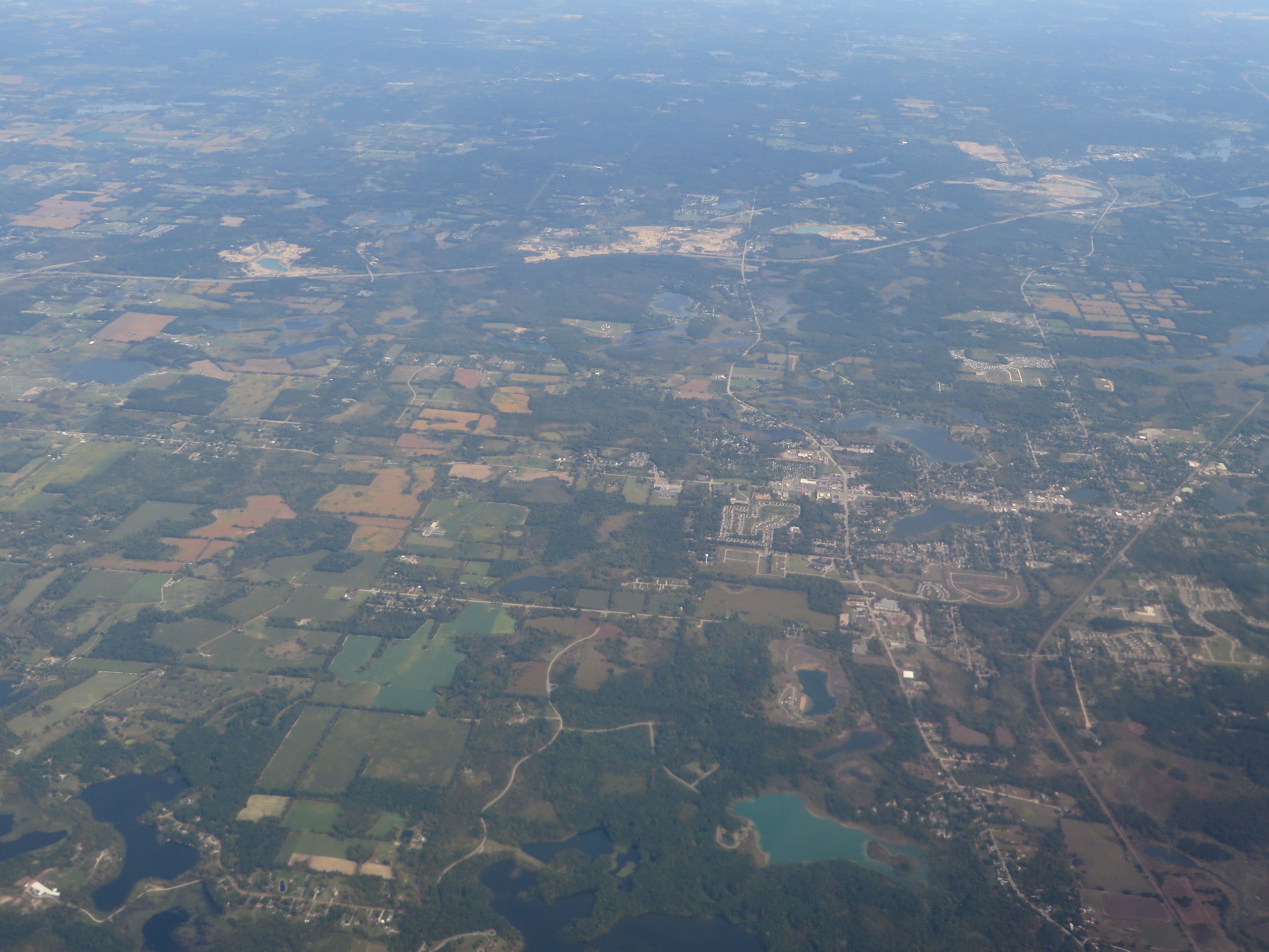
Holly is a village in north Oakland County in the U.S. state of Michigan. The population was 6,086 at the 2010 census. The village is located almost entirely within Holly Township with a very small portion extending into Rose Township. It is about 15 miles (24 km) south of Flint and 55 miles (89 km) northwest of Detroit. Holly is home to the Annual Holly Dickens Festival and to the Michigan Renaissance Festival, which was the main shooting location for the 2009 film All's Faire in Love. It is also the starting point of the Shiawassee River Heritage Water Trail at WaterWorks Park. Mount Holly, the largest ski/snowboard resort in southeastern Michigan, is located 3 miles (5 km) northeast of the village in Groveland Township. The ski area has 19 trails with a range of difficulty, and a high-speed quad chairlift. Also nearby is the state owned Holly Recreation Area. Crapo Park, named after Michigan Governor Henry H. Crapo (1804–1869), located near the junction of the CSX Saginaw Subdivision and Canadian National Railway's Holly Subdivision is a popular viewing location for railfans. Both lines were formerly served by Holly's small (now abandoned) railroad depot, built in 1886. A nonprofit group is currently attempting to restore the neglected building to its former glory. <a href="https://en.wikipedia.org/wiki/Holly,_Michigan" rel="nofollow">en.wikipedia.org/wiki/Holly,_Michigan</a> <a href="https://en.wikipedia.org/wiki/Wikipedia:Text_of_Creative_Commons_Attribution-ShareAlike_3.0_Unported_License" rel="nofollow">en.wikipedia.org/wiki/Wikipedia:Text_of_Creative_Commons_...</a> |
| Date | |
| Source | Holly, Michigan |
| Author | Ken Lund from Reno, Nevada, USA |
| Camera location | | View this and other nearby images on: OpenStreetMap |
|---|
.jpg¶ms=042.806420_N_-083.628134_E_globe:Earth_type:camera_source:Flickr_&language=en)
Licensing
[edit].jpg&action=edit§ion=2)
- You are free:
- to share – to copy, distribute and transmit the work
- to remix – to adapt the work
- Under the following conditions:
- attribution – You must give appropriate credit, provide a link to the license, and indicate if changes were made. You may do so in any reasonable manner, but not in any way that suggests the licensor endorses you or your use.
- share alike – If you remix, transform, or build upon the material, you must distribute your contributions under the same or compatible license as the original.
| This image was originally posted to Flickr by Ken Lund at https://flickr.com/photos/75683070@N00/21079474294. It was reviewed on 8 November 2020 by FlickreviewR 2 and was confirmed to be licensed under the terms of the cc-by-sa-2.0. |
File history
Click on a date/time to view the file as it appeared at that time.
| Date/Time | Thumbnail | Dimensions | User | Comment | |
|---|---|---|---|---|---|
| current | 19:32, 8 November 2020 | | 4,000 × 3,000 (3.12 MB) | Orizan (talk | contribs) | Transferred from Flickr via #flickr2commons |
You cannot overwrite this file.
File usage on Commons
There are no pages that use this file.
.jpg&oldid=734829220)