File:Holliston-map.png
Jump to navigation
Jump to search
No higher resolution available.
Holliston-map.png (330 × 250 pixels, file size: 22 KB, MIME type: image/png)
Captions
Captions
Add a one-line explanation of what this file represents
Summary
[edit]
| Description |
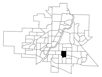
English: A map showing the location of the Holliston neighbourhood in relation to the other neighbourhoods in Saskatoon. |
| Source | http://www.saskatoon.ca/DEPARTMENTS/Community%20Services/PlanningDevelopment/BusinessLicenseMappingAndResearch/DemographicAndHousingData/Documents/2007/holliston.pdf |
| Author | City of Saskatoon - Planning & Development Branch |
| Permission (Reusing this file) |
Licensing
[edit]

|
The copyright holder of this file allows anyone to use it for any purpose, provided that the copyright holder is properly attributed. Redistribution, derivative work, commercial use, and all other use is permitted. |
|
|
File history
Click on a date/time to view the file as it appeared at that time.
| Date/Time | Thumbnail | Dimensions | User | Comment | |
|---|---|---|---|---|---|
| current | 19:30, 7 November 2009 | | 330 × 250 (22 KB) | Drm310 (talk | contribs) | {{Information |Description={{en|1=A map showing the location of the Holliston neighbourhood in relation to the other neighbourhoods in Saskatoon.}} |Source=http://www.saskatoon.ca/DEPARTMENTS/Community%20Services/PlanningDevelopment/BusinessLicenseMapping |
You cannot overwrite this file.
File usage on Commons
The following page uses this file:
File usage on other wikis
The following other wikis use this file:
- Usage on en.wikipedia.org
- Usage on www.wikidata.org