File:Hohnbachtal, Wiese.jpg
Original file (600 × 800 pixels, file size: 375 KB, MIME type: image/jpeg)
Captions
Summary
[edit]DescriptionHohnbachtal, Wiese.jpg |
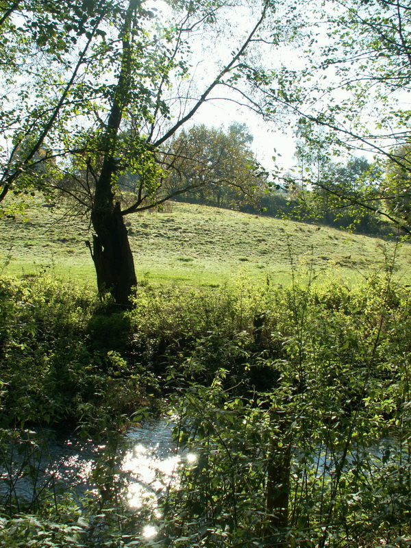
Nederlands: Het Staatsbos Hohnbachtal wordt door weilanden omgeven. In dit gedeelte van het dal zijn geen wegen. De weilanden zijn alleen via andere weilanden te bereiken. Deutsch: Der Staatswald Hohnbachtal wird von Wiesen umgeben. In diesem Teil des Tales gibt es keine Straßen, die Wiesen sind nur über andere Wiesen zu erreichen. Français : La forêt domaniale de la vallé de la Hohn est entouré par de prairies. Dans cette partie de la vallée il n'y a pas de rues. Les prairies ne sont accessibles que par des autres prairies. English: The state forest Hohnbachtal is surrounded by meadows. There aren't any streets in this part of the valley, the meadows can be reached only by other meadows.
|
||
Date | |||
Source | Own work | ||
Author | 19Arnold45 |
Camera location | 50° 41′ 38.9″ N, 5° 59′ 45.8″ E | View this and other nearby images on: OpenStreetMap | 50.694140; 5.996055 |
---|
Licensing
[edit]- You are free:
- to share – to copy, distribute and transmit the work
- to remix – to adapt the work
- Under the following conditions:
- attribution – You must give appropriate credit, provide a link to the license, and indicate if changes were made. You may do so in any reasonable manner, but not in any way that suggests the licensor endorses you or your use.
- share alike – If you remix, transform, or build upon the material, you must distribute your contributions under the same or compatible license as the original.
This image was uploaded as part of Wiki Loves Monuments 2013.
Afrikaans ∙ Alemannisch ∙ العربية ∙ جازايرية ∙ azərbaycanca ∙ Bikol Central ∙ беларуская ∙ беларуская (тарашкевіца) ∙ български ∙ বাংলা ∙ brezhoneg ∙ bosanski ∙ català ∙ čeština ∙ Cymraeg ∙ dansk ∙ Deutsch ∙ Zazaki ∙ Ελληνικά ∙ English ∙ Esperanto ∙ español ∙ eesti ∙ euskara ∙ فارسی ∙ suomi ∙ français ∙ Frysk ∙ Gaeilge ∙ galego ∙ עברית ∙ हिन्दी ∙ hrvatski ∙ magyar ∙ հայերեն ∙ Bahasa Indonesia ∙ Ido ∙ italiano ∙ 日本語 ∙ ქართული ∙ 한국어 ∙ кыргызча ∙ Lëtzebuergesch ∙ latviešu ∙ Malagasy ∙ македонски ∙ മലയാളം ∙ Bahasa Melayu ∙ Malti ∙ norsk bokmål ∙ नेपाली ∙ Nederlands ∙ norsk nynorsk ∙ norsk ∙ polski ∙ português ∙ português do Brasil ∙ română ∙ русский ∙ sicilianu ∙ davvisámegiella ∙ slovenčina ∙ slovenščina ∙ shqip ∙ српски / srpski ∙ svenska ∙ ไทย ∙ Tagalog ∙ Türkçe ∙ українська ∙ اردو ∙ oʻzbekcha / ўзбекча ∙ Yorùbá ∙ 中文 ∙ 中文(中国大陆) ∙ 中文(简体) ∙ 中文(繁體) ∙ 中文(香港) ∙ 中文(臺灣) ∙ +/− |
File history
Click on a date/time to view the file as it appeared at that time.
Date/Time | Thumbnail | Dimensions | User | Comment | |
---|---|---|---|---|---|
current | 22:50, 28 September 2013 | 600 × 800 (375 KB) | 19Arnold45 (talk | contribs) | User created page with UploadWizard |
You cannot overwrite this file.
File usage on Commons
There are no pages that use this file.
File usage on other wikis
The following other wikis use this file:
- Usage on de.wikipedia.org
Metadata
This file contains additional information such as Exif metadata which may have been added by the digital camera, scanner, or software program used to create or digitize it. If the file has been modified from its original state, some details such as the timestamp may not fully reflect those of the original file. The timestamp is only as accurate as the clock in the camera, and it may be completely wrong.
Image title | KONICA MINOLTA DIGITAL CAMERA |
---|---|
Camera manufacturer | KONICA MINOLTA |
Camera model | DiMAGE Z5 |
Exposure time | 1/125 sec (0.008) |
F-number | f/5 |
ISO speed rating | 50 |
Date and time of data generation | 11:51, 16 October 2005 |
Lens focal length | 5.859375 mm |
Orientation | Normal |
Horizontal resolution | 72 dpi |
Vertical resolution | 72 dpi |
Software used | ACD Systems Digital Imaging |
File change date and time | 23:44, 1 April 2011 |
Y and C positioning | Centered |
Exposure Program | Normal program |
Exif version | 2.2 |
Date and time of digitizing | 11:51, 16 October 2005 |
Meaning of each component |
|
APEX brightness | 7.7 |
APEX exposure bias | 0 |
Maximum land aperture | 3 APEX (f/2.83) |
Metering mode | Pattern |
Light source | Unknown |
Flash | Flash did not fire, auto mode |
DateTime subseconds | 322 |
Supported Flashpix version | 1 |
Color space | sRGB |
Custom image processing | Normal process |
Exposure mode | Auto exposure |
White balance | Auto white balance |
Digital zoom ratio | 0 |
Focal length in 35 mm film | 35 mm |
Scene capture type | Standard |
Scene control | None |
Contrast | Normal |
Saturation | Normal |
Sharpness | Normal |
Subject distance range | Distant view |
Structured data
Items portrayed in this file
depicts
16 October 2005
50°41'38.904"N, 5°59'45.798"E
0.008 second
5.859375 millimetre
image/jpeg
- Cultural heritage monuments of German speaking community of Belgium with known IDs
- Files with coordinates missing SDC location of creation (50° N, 5° E)
- CC-BY-SA-3.0
- Self-published work
- Images from Wiki Loves Monuments 2013
- Images from Wiki Loves Monuments 2013 in Belgium
- Images from Wiki Loves Monuments missing SDC depicts
- Images from Wiki Loves Monuments missing SDC location of creation
- Uploaded via Campaign:wlm-be-wal
- Belgium photographs taken on 2005-10-16