File:Hohler Stein Niederal 2014 Tafel.jpg
Jump to navigation
Jump to search
Size of this preview: 800 × 533 pixels. Other resolutions: 320 × 213 pixels | 640 × 426 pixels | 1,024 × 682 pixels | 1,280 × 852 pixels | 2,560 × 1,705 pixels | 3,184 × 2,120 pixels.
Original file (3,184 × 2,120 pixels, file size: 2.9 MB, MIME type: image/jpeg)
Captions
Captions
Description of the "Hohler Stein" near Vent (Otztal)
Summary
[edit]
| Description |
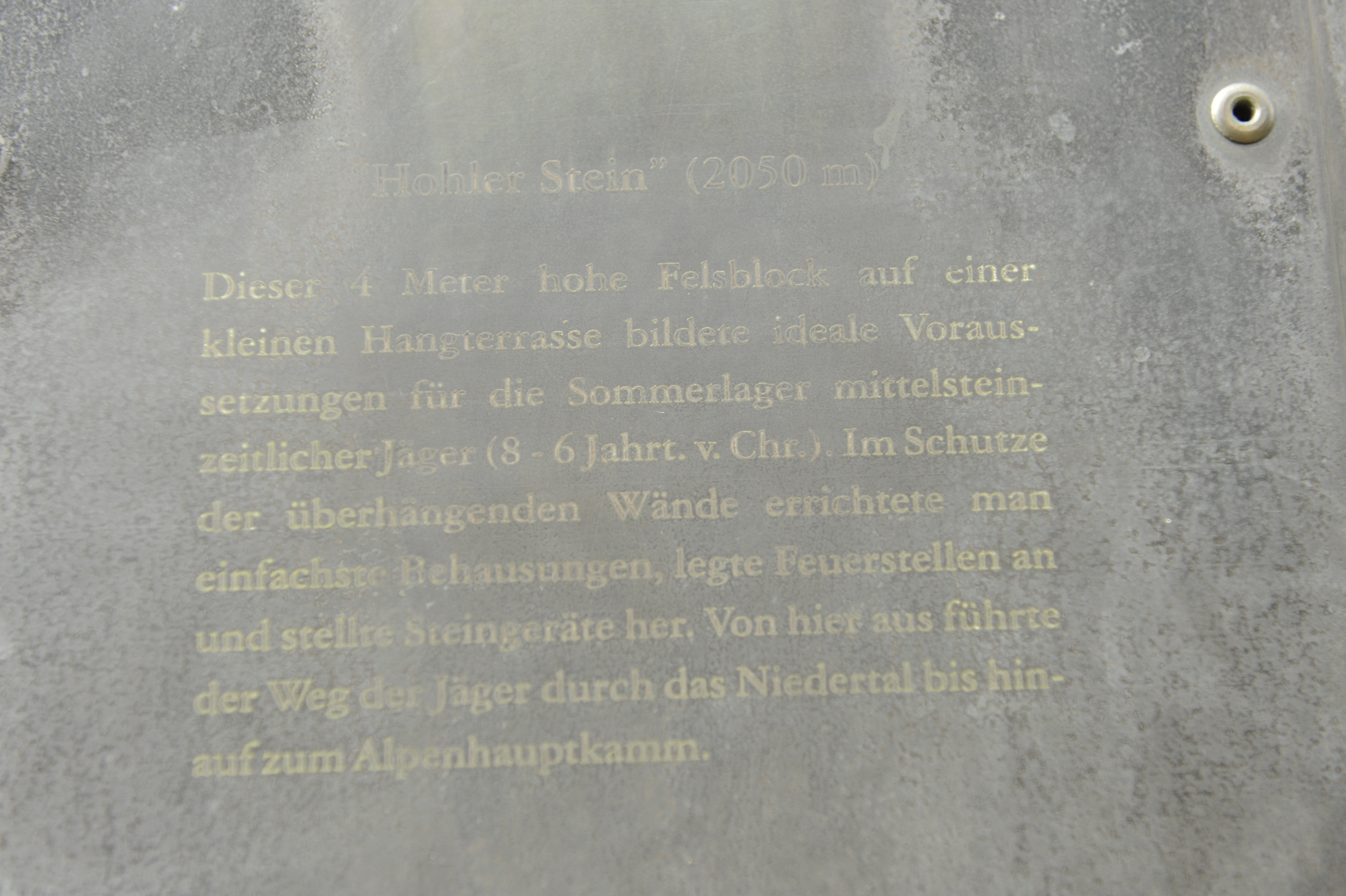
English: Inscription that describes the use of this rock as a shelter in times of the 8th to 6th century before Christ. |
| Date | |
| Source | Own work |
| Author | R. J. Mathar |
"Hohler Stein" (2050m ) Dieser 4 Meter hohe Felsblock auf einer kleinen Hangterrasse bildete ideale Voraussetzungen für die Sommerlager mittelsteinzeitlicher Jäger (8-6 Jahrt. v. Chr.). Im Schutze der überhängenden Wände errichtet man einfachste Behausungen, legte Feuerstellen an und stellte Steingeräte her. Von hier aus führte der Weg der Jäger durch das Niedertal bis hinauf zum Alpenhauptkamm.
Licensing
[edit]
I, the copyright holder of this work, hereby publish it under the following license:
This file is licensed under the Creative Commons Attribution-Share Alike 4.0 International license.
- You are free:
- to share – to copy, distribute and transmit the work
- to remix – to adapt the work
- Under the following conditions:
- attribution – You must give appropriate credit, provide a link to the license, and indicate if changes were made. You may do so in any reasonable manner, but not in any way that suggests the licensor endorses you or your use.
- share alike – If you remix, transform, or build upon the material, you must distribute your contributions under the same or compatible license as the original.
File history
Click on a date/time to view the file as it appeared at that time.
| Date/Time | Thumbnail | Dimensions | User | Comment | |
|---|---|---|---|---|---|
| current | 19:09, 12 November 2022 | | 3,184 × 2,120 (2.9 MB) | R. J. Mathar (talk | contribs) | Uploaded own work with UploadWizard |
You cannot overwrite this file.
File usage on Commons
The following 2 pages use this file: