File:Hoeytown Louisiana from Norman Chart.jpg
Jump to navigation
Jump to search
Size of this preview: 800 × 547 pixels. Other resolutions: 320 × 219 pixels | 640 × 438 pixels | 1,047 × 716 pixels.
Original file (1,047 × 716 pixels, file size: 176 KB, MIME type: image/jpeg)
Captions
Captions
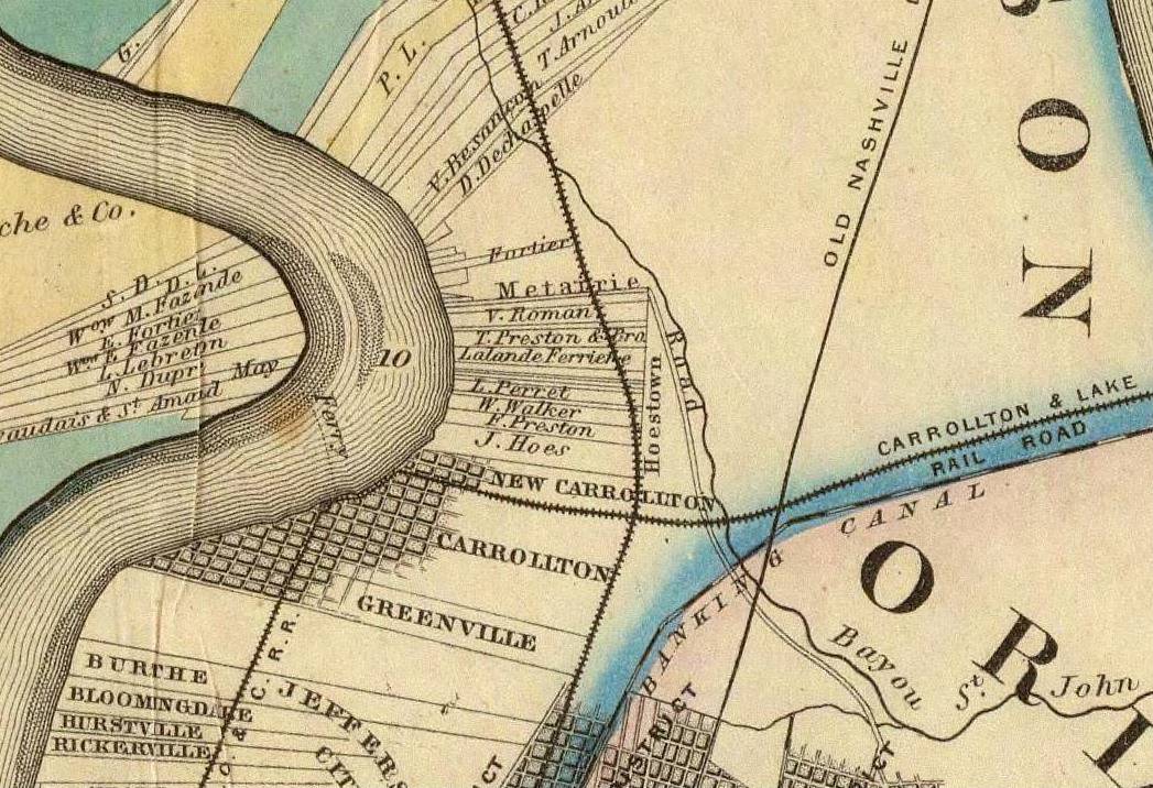
1858 map of what is now Old Jefferson, Jefferson Parish, Louisiana, and surrounding area
Summary
[edit]
| Description |
English: cropped portion of Norman's Cart of the Lower Mississippi River, 1858, showing what is now Old Jefferson, Jefferson Parish, Louisiana, as well as surrounding areas including Metairie Road, Carrollton Louisiana (since annexed by New Orleans), and Nine Mile Point. Shows landowner/plantation boundaries, and areas such as "Hoestown" (better remembered as Hoeyville). |
| Date | |
| Source |
Cropped section of 1858 "Norman's Chart of the Lower Mississippi River". Via [1] |
| Author | Benjamin Moore Norman (1809-1860) and Marie Adrien Persac (1823-1873). |
Licensing
[edit]
|
This work is in the public domain in its country of origin and other countries and areas where the copyright term is the author's life plus 100 years or fewer. This work is in the public domain in the United States because it was published (or registered with the U.S. Copyright Office) before January 1, 1929. | |
| This file has been identified as being free of known restrictions under copyright law, including all related and neighboring rights. | |
File history
Click on a date/time to view the file as it appeared at that time.
| Date/Time | Thumbnail | Dimensions | User | Comment | |
|---|---|---|---|---|---|
| current | 18:08, 3 February 2019 | | 1,047 × 716 (176 KB) | Infrogmation (talk | contribs) | User created page with UploadWizard |
You cannot overwrite this file.
File usage on Commons
There are no pages that use this file.
File usage on other wikis
The following other wikis use this file:
- Usage on en.wikipedia.org