File:Hochneukirchen - Hutwisch mit Aussichtswarte.JPG
Jump to navigation
Jump to search
Size of this preview: 800 × 600 pixels. Other resolutions: 320 × 240 pixels | 640 × 480 pixels | 1,024 × 768 pixels | 1,280 × 960 pixels | 2,560 × 1,920 pixels | 4,800 × 3,600 pixels.
Original file (4,800 × 3,600 pixels, file size: 11.17 MB, MIME type: image/jpeg)
Captions
Captions
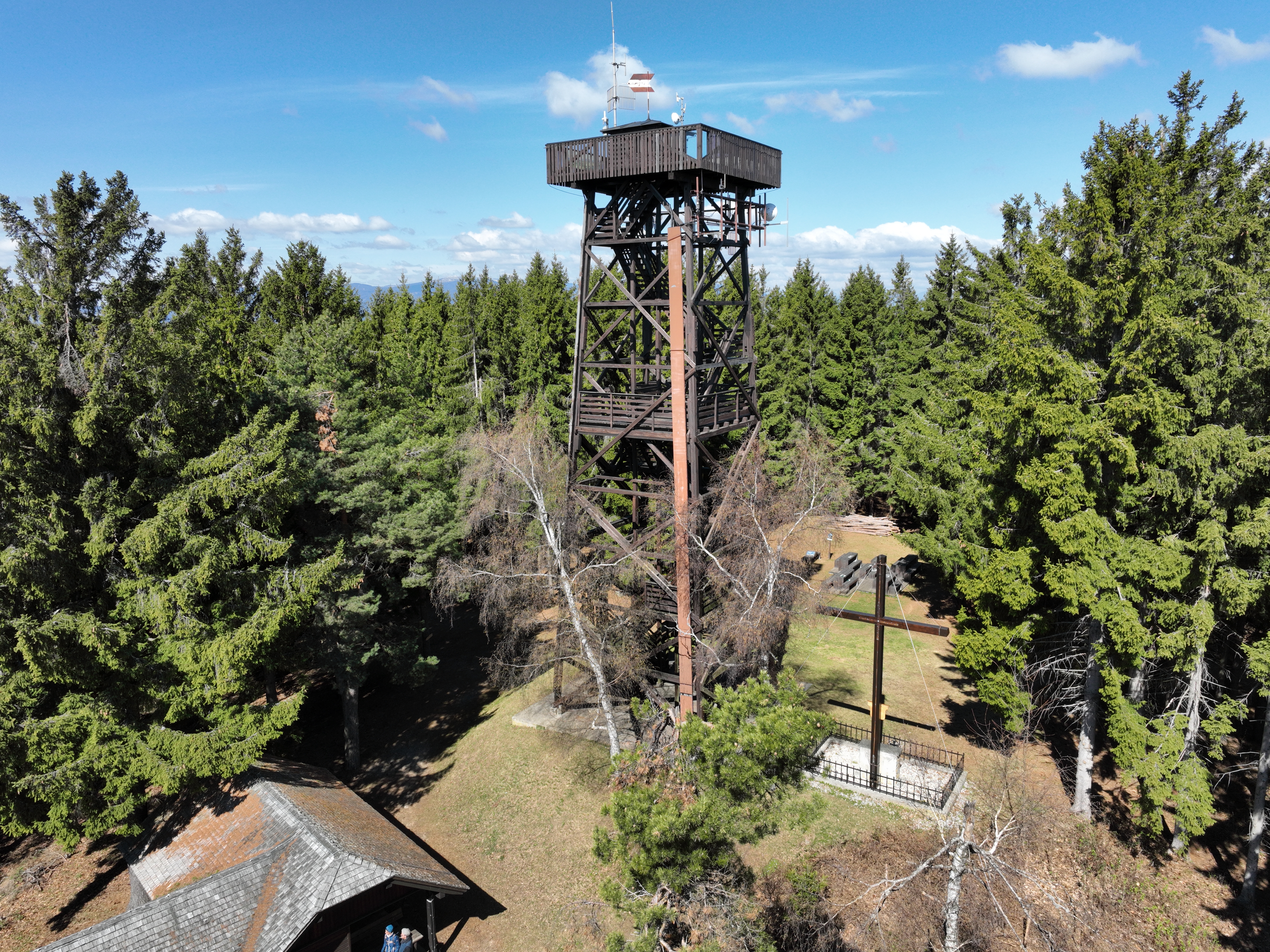
Summit area of the Hutwisch with observation tower, Lower Austria.
Summary
[edit]| Description |
Deutsch: Der Gipfelbereich des Hutwisch mit der Kernstockwarte bzw. Hutwischwarte in der niederösterreichischen Marktgemeinde Hochneukirchen-Gschaidt.
Der 896 m hohe Hutwisch ist einer der höchsten Berge der Buckligen Welt und bereits 1882 baute man auf dem Gipfel auf Initiative des Österreichischen Touristenklubs einen 8,5 m hohen hölzernen Aussichtsturm. 1929 wurde eine neue 14 m hohe Aussichtswarte vom Verschönerungsverein Hochneukirchen errichtet und am 15. Juni 1930 feierlich eröffnet. Zu Ehren des steirischen Heimatdichters Ottokar Kernstock erhielt sie den Namen „Kernstockwarte“. Ab 1939 übernahm die Gemeinde Hochneukirchen (später Gemeinde Hochneukirchen-Gschaidt) die Instandhaltung der Warte und ersetzte sie 1978 durch eine neue, die eine Höhe von 22 m hat und 820.000 Schilling kostete (lt. Infotafel vor Ort). Auf dem Gipfel befindet sich auch noch ein großes Kreuz in Gedenken der Gefallenen des Zweiten Weltkrieges aus der Buckligen Welt, das 1951 errichtet wurde (lt. Infotafel bei der Hutwischhütte). Weiters gibt es noch die 1992 erbaute „Hutwischhütte“ sowie ein Toilettenhäuschen und ein flaches Areal mit neumodernen Tischen und Sitzbänken. English: Summit area of the Hutwisch with observation tower, Lower Austria. |
| Date | |
| Source | Own work |
| Author | C.Stadler/Bwag |
| Permission (Reusing this file) |
Deutsch: Hallo, du darfst meine Fotos kostenlos nutzen, aber nenne mich bitte als Fotograf, beispielsweise „Foto: C.Stadler/Bwag“ oder © C.Stadler/Bwag; CC-BY-SA-4.0. Auf mehr Angaben bestehe ich nicht - im Gegensatz zu manch anderen, die die Vorgaben der unten angeführten Lizenzierung auf Punkt und Beistrich einfordern. English: Feel free to use my photos, but please mention me as the author like © C.Stadler/Bwag or © C.Stadler/Bwag; CC-BY-SA-4.0 (that's good enough) and if you want send me a message: bwag@gmx.net. |
| Other versions |
|

| Object location | | View this and other nearby images on: OpenStreetMap |
|---|
| Camera location | | View this and other nearby images on: OpenStreetMap |
|---|
Licensing
[edit]
I, the copyright holder of this work, hereby publish it under the following license:
This file is licensed under the Creative Commons Attribution-Share Alike 4.0 International license.
- You are free:
- to share – to copy, distribute and transmit the work
- to remix – to adapt the work
- Under the following conditions:
- attribution – You must give appropriate credit, provide a link to the license, and indicate if changes were made. You may do so in any reasonable manner, but not in any way that suggests the licensor endorses you or your use.
- share alike – If you remix, transform, or build upon the material, you must distribute your contributions under the same or compatible license as the original.
File history
Click on a date/time to view the file as it appeared at that time.
| Date/Time | Thumbnail | Dimensions | User | Comment | |
|---|---|---|---|---|---|
| current | 19:39, 23 April 2022 | | 4,800 × 3,600 (11.17 MB) | Bwag (talk | contribs) | == {{int:filedesc}} == {{Information |Description= {{de|1= Der Gipfelbereich des Hutwisch mit der Kernstockwarte bzw. Hutwischwarte in der niederösterreichischen Marktgemeinde Hochneukirchen-Gschaidt.<br/>Der 896 m hohe Hutwisch ist einer der höchsten Berge der Buckligen Welt und bereits 1882 baute man auf dem Gipfel auf Initiative des Österreichischen Touristenklubs einen 8,5 m hohen hölzernen Aussichtsturm. 1929 wurde eine neue 14 m hohe Aussichtswarte vom Verschönerungsverein Hochneukirch... |
You cannot overwrite this file.
File usage on Commons
The following 3 pages use this file:
File usage on other wikis
The following other wikis use this file:
- Usage on de.wikipedia.org
- Usage on en.wikipedia.org
- Usage on www.wikidata.org