File:Hochfelden Dufourkarte.jpg
Jump to navigation
Jump to search
Size of this preview: 777 × 600 pixels. Other resolutions: 311 × 240 pixels | 622 × 480 pixels | 810 × 625 pixels.
Original file (810 × 625 pixels, file size: 368 KB, MIME type: image/jpeg)
Captions
Captions
Add a one-line explanation of what this file represents
Summary
[edit]
| Description |
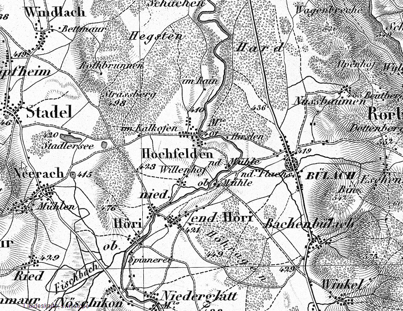
English: Hochfelden: Segment from the Dufour map Blatt 3, "Liestal, Schaffhausen", from 1869, Scale 1:100'000
Deutsch: Hochfelden: Ausschnitt aus der Dufourkarte Blatt 3, "Liestal, Schaffhausen", von 1869, Massstab 1:100'000 |
| Date | |
| Source | map.geo.admin.ch (Permalink) |
| Author | Dufouratlas |
| Map legend |
Deutsch: Zeichen und Abkürzungen |
|||||||||
| Geotemporal data | ||||||||||
| Scale | 1:100,000 | |||||||||
| Bounding box |
|
|||||||||
| Georeferencing | ||||||||||
| Bibliographic data | ||||||||||
| Map sheet | 3 (crop) | |||||||||
Licensing
[edit]
|
This work is in the public domain in its country of origin and other countries and areas where the copyright term is the author's life plus 70 years or fewer. | |
| This file has been identified as being free of known restrictions under copyright law, including all related and neighboring rights. | |
File history
Click on a date/time to view the file as it appeared at that time.
| Date/Time | Thumbnail | Dimensions | User | Comment | |
|---|---|---|---|---|---|
| current | 10:08, 4 March 2010 | | 810 × 625 (368 KB) | Foho8182 (talk | contribs) | {{Information |Description= {{en|Hochfelden: Segment from the Dufour map from 1865, Scale 1:100'000}} {{de|Hochfelden: Ausschnitt aus der Dufourkarte von 1865, Massstab 1:100'000}} |Source= [http://map.geo.admin.ch map.geo.admin.ch] |Da |
You cannot overwrite this file.
File usage on Commons
There are no pages that use this file.
File usage on other wikis
The following other wikis use this file:
- Usage on de.wikipedia.org