File:Hochalmkreuz.jpg
Jump to navigation
Jump to search
Size of this preview: 800 × 532 pixels. Other resolutions: 320 × 213 pixels | 640 × 426 pixels | 1,024 × 681 pixels | 1,280 × 851 pixels | 2,000 × 1,330 pixels.
Original file (2,000 × 1,330 pixels, file size: 1.44 MB, MIME type: image/jpeg)
Captions
Captions
Add a one-line explanation of what this file represents
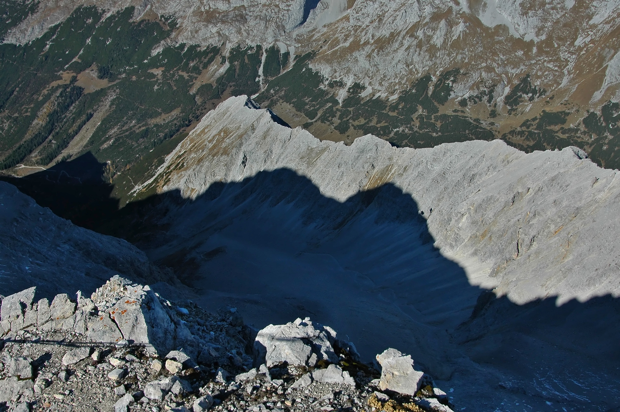
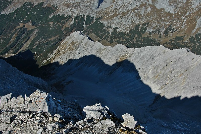
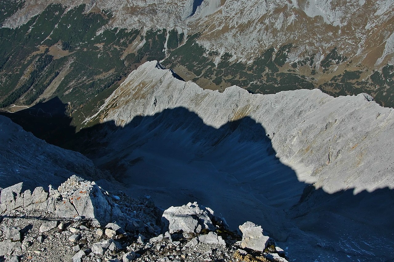
| Description | Hochalmkreuz mit Schlauchkar |
| Date | |
| Source | Own work |
| Author | Kogo |
| Camera location | | View this and other nearby images on: OpenStreetMap |
|---|
This file is licensed under the Creative Commons Attribution-Share Alike 3.0 Germany license.
Attribution: kogo
- You are free:
- to share – to copy, distribute and transmit the work
- to remix – to adapt the work
- Under the following conditions:
- attribution – You must give appropriate credit, provide a link to the license, and indicate if changes were made. You may do so in any reasonable manner, but not in any way that suggests the licensor endorses you or your use.
- share alike – If you remix, transform, or build upon the material, you must distribute your contributions under the same or compatible license as the original.

File history
Click on a date/time to view the file as it appeared at that time.
| Date/Time | Thumbnail | Dimensions | User | Comment | |
|---|---|---|---|---|---|
| current | 14:37, 7 March 2015 | | 2,000 × 1,330 (1.44 MB) | Kogo (talk | contribs) | {{Information |Description=Hochalmkreuz mit Schlauchkar |Source={{own}} |Date=2005-10-22 |Author= Kogo |Permission= |other_versions= }} {{Cc-by-sa-3.0-de |1=kogo }} Category:Mountains of Karwendel Category:2190s mountains |
You cannot overwrite this file.
File usage on Commons
There are no pages that use this file.
File usage on other wikis
The following other wikis use this file:
- Usage on ceb.wikipedia.org
- Usage on de.wikipedia.org
- Usage on fr.wikipedia.org
- Usage on lld.wikipedia.org
- Usage on www.wikidata.org