File:Historical map of Bakhmut in Ukraine (cropped).jpg
Jump to navigation
Jump to search

Size of this preview: 800 × 562 pixels. Other resolutions: 320 × 225 pixels | 640 × 450 pixels | 1,024 × 720 pixels | 1,280 × 900 pixels | 2,560 × 1,799 pixels | 8,250 × 5,799 pixels.
Original file (8,250 × 5,799 pixels, file size: 3.26 MB, MIME type: image/jpeg)
Captions
Captions
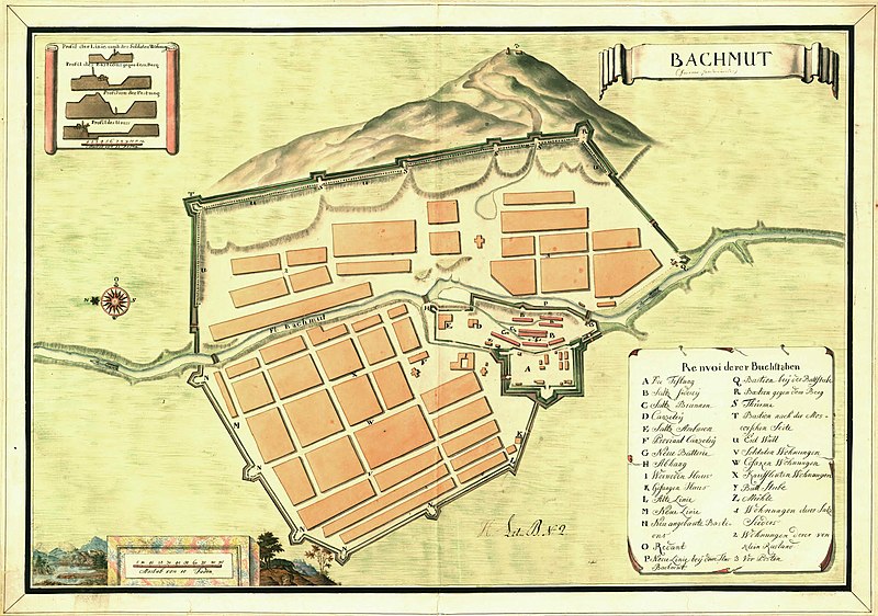
Historical map of Bakhmut, Ukraine
Summary
[edit]| Description |
English: Historical map of Bakhmut in Ukraine, possibly 17th centrury. The map also includes cross-sections of the fortification walls. |
||||||||||||||||||||||||||
| Date | Possibly 17th century | ||||||||||||||||||||||||||
| Source |
Utländska stads- och fästningsplaner, Bachmut, SE/KrA/0406/19/004/001, bildid: K0004367_00001 https://sok.riksarkivet.se/arkiv/0rjBXKbS5aY5ZrCxWRyyFD |
||||||||||||||||||||||||||
| Creator |
Unknown author |
||||||||||||||||||||||||||
| Permission (Reusing this file) |
|
||||||||||||||||||||||||||
| Georeferencing | If inappropriate please set warp_status = skip to hide. | ||||||||||||||||||||||||||
| Other versions | |||||||||||||||||||||||||||


.jpg&action=edit§ion=1)
Licensing
[edit].jpg&action=edit§ion=2)
|
This work is in the public domain in its country of origin and other countries and areas where the copyright term is the author's life plus 70 years or fewer. | |
| This file has been identified as being free of known restrictions under copyright law, including all related and neighboring rights. | |
File history
Click on a date/time to view the file as it appeared at that time.
| Date/Time | Thumbnail | Dimensions | User | Comment | |
|---|---|---|---|---|---|
| current | 13:21, 29 September 2022 | | 8,250 × 5,799 (3.26 MB) | DivadH (talk | contribs) | File:Historical map of Bakhmut in Ukraine.jpg cropped 1 % horizontally, 8 % vertically using CropTool with precise mode. |
You cannot overwrite this file.
File usage on Commons
The following 2 pages use this file:
File usage on other wikis
The following other wikis use this file:
- Usage on de.wikipedia.org
- Usage on el.wikipedia.org
- Usage on en.wikipedia.org
- Usage on es.wikipedia.org
- Usage on gl.wikipedia.org
- Usage on it.wikipedia.org
- Usage on outreach.wikimedia.org
- Usage on pt.wikipedia.org
- Usage on sl.wikipedia.org
- Usage on sv.wikipedia.org
.jpg&oldid=846216002)