File:Historical hand-atlas, illustrated, containing large scale copper plate maps of each state and territory of the United States, and the provinces of Canada, together with a complete reference map LOC 2008622013-23.jpg
Jump to navigation
Jump to search

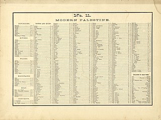
Size of this preview: 800 × 598 pixels. Other resolutions: 320 × 239 pixels | 640 × 479 pixels | 1,024 × 766 pixels | 1,280 × 957 pixels | 2,560 × 1,915 pixels | 4,308 × 3,222 pixels.
Original file (4,308 × 3,222 pixels, file size: 2.65 MB, MIME type: image/jpeg)
Captions
Captions
Add a one-line explanation of what this file represents
Summary
[edit]| Description |
English: LeGear. Atlases of the United States, 4583 Includes indexes, brief history of Wells County, and brief biographies of early Wells County residents. Available also through the Library of Congress Web site as a raster image. Vendor: John Carbonell Acquisitions control no. 2008-053 |
||
| Title | Historical hand-atlas, illustrated, containing large scale copper plate maps of each state and territory of the United States, and the provinces of Canada, together with a complete reference map of the world, topographical and railroad map of the United States, thirteen comprehensive maps of bible geography ... : nine farm maps and history of Wells County, Indiana, illustrated, containing a condensed history of the county, biographical sketches, general statistics, miscellaneous matters, &c. | ||
| Shelf ID | G1200 .H375 1881 | ||
| Parent | https://www.loc.gov/resource/g3700m.gla00129/ | ||
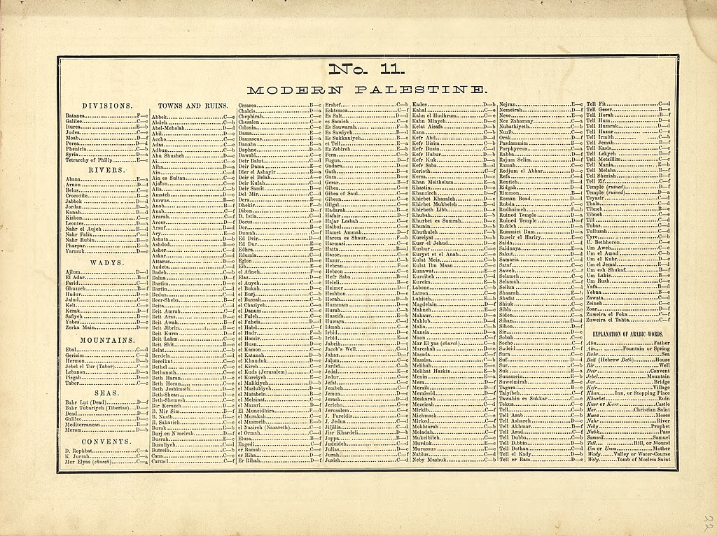
| Sheet title | No. 11 Modern Palestine | ||
| Date | |||
| Source | https://www.loc.gov/item/2008622013/ | ||
| Author | H.H. Hardesty (Firm) | ||
| Permission (Reusing this file) |
|
||
| Other versions |
|
||
| Location | United States · Indiana · Wells County | ||
| Part of | American Memory · Catalog · County Landownership Maps · Geography And Map Division · Cultural Landscapes | ||
| Subject | Bible · Wells County · Wells County (Ind.) · United States · Maps · Indiana · Real Property · Geography · Landowners · Biography · History |

Licensing
[edit]
|
This is a faithful photographic reproduction of a two-dimensional, public domain work of art. The work of art itself is in the public domain for the following reason:
The official position taken by the Wikimedia Foundation is that "faithful reproductions of two-dimensional public domain works of art are public domain".
This photographic reproduction is therefore also considered to be in the public domain in the United States. In other jurisdictions, re-use of this content may be restricted; see Reuse of PD-Art photographs for details. | ||||
File history
Click on a date/time to view the file as it appeared at that time.
| Date/Time | Thumbnail | Dimensions | User | Comment | |
|---|---|---|---|---|---|
| current | 11:24, 10 August 2018 | | 4,308 × 3,222 (2.65 MB) | Fæ (talk | contribs) | LOC Maps multisheet https://www.loc.gov/item/2008622013/ sheet 23 of 193 #11903 |
You cannot overwrite this file.
File usage on Commons
The following page uses this file: