File:Hipparchia fidia. Salasc.jpg
From Wikimedia Commons, the free media repository
Jump to navigation
Jump to search
Hipparchia_fidia._Salasc.jpg (240 × 160 pixels, file size: 62 KB, MIME type: image/jpeg)
File information
Structured data
Captions
Summary
[edit]Camera location | 43° 37′ 50.18″ N, 3° 19′ 17.11″ E | View this and other nearby images on: OpenStreetMap | 43.630605; 3.321420 |
---|
DescriptionHipparchia fidia. Salasc.jpg |
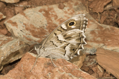
Français : GPS (WGS84): 43°37'50.178"N; 03°19'17.112"E. Altitude: 178m. |
Date | |
Source | Own work |
Author | TITRE Bernard |
Permission (Reusing this file) |
TITRE Bernard |
Licensing
[edit]I, the copyright holder of this work, hereby publish it under the following license:
Copyleft: This work of art is free; you can redistribute it and/or modify it according to terms of the Free Art License. You will find a specimen of this license on the Copyleft Attitude site as well as on other sites. http://artlibre.org/licence/lal/enFALFree Art Licensefalsetrue |
File history
Click on a date/time to view the file as it appeared at that time.
Date/Time | Thumbnail | Dimensions | User | Comment | |
---|---|---|---|---|---|
current | 09:36, 17 December 2008 | 240 × 160 (62 KB) | TITRE Bernard~commonswiki (talk | contribs) | {{Information |Description={{fr|1=GPS (WGS84): 43°37'50.178"N; 03°19'17.112"E. Altitude: 178m.}} |Source=travail personnel (own work) |Author=TITRE Bernard |Date=20/07/2008 07:42:26 |Permission=TITRE Bernard |other_versions= }} < |
You cannot overwrite this file.
File usage on Commons
The following page uses this file:
File usage on other wikis
The following other wikis use this file:
- Usage on en.wikipedia.org
- Usage on pt.wikipedia.org
- Usage on sv.wikipedia.org
- Usage on vi.wikipedia.org
Metadata
This file contains additional information such as Exif metadata which may have been added by the digital camera, scanner, or software program used to create or digitize it. If the file has been modified from its original state, some details such as the timestamp may not fully reflect those of the original file. The timestamp is only as accurate as the clock in the camera, and it may be completely wrong.
Camera manufacturer | NIKON CORPORATION |
---|---|
Camera model | NIKON D2X |
Exposure time | 1/320 sec (0.003125) |
F-number | f/32 |
Date and time of data generation | 07:42, 20 July 2008 |
Lens focal length | 180 mm |
User comments |
|
Latitude | 43° 37′ 50.18″ N |
Longitude | 3° 19′ 17.11″ E |
Altitude | 178 meters above sea level |
Orientation | Normal |
Horizontal resolution | 72 dpi |
Vertical resolution | 72 dpi |
Software used | Adobe Photoshop CS3 Windows |
File change date and time | 09:29, 17 December 2008 |
Y and C positioning | Centered |
Exposure Program | Manual |
Date and time of digitizing | 07:42, 20 July 2008 |
APEX shutter speed | −0.067452830188679 |
APEX aperture | 10 |
APEX exposure bias | 0 |
Maximum land aperture | 3.6 APEX (f/3.48) |
Metering mode | Spot |
Light source | Shade |
Flash | Flash did not fire |
DateTime subseconds | 0 |
DateTimeOriginal subseconds | 0 |
DateTimeDigitized subseconds | 0 |
Sensing method | One-chip color area sensor |
File source | Digital still camera |
Scene type | A directly photographed image |
Custom image processing | Normal process |
Exposure mode | Manual exposure |
White balance | Manual white balance |
Digital zoom ratio | 1 |
Focal length in 35 mm film | 270 mm |
Scene capture type | Standard |
Scene control | Low gain up |
Contrast | Normal |
Saturation | Normal |
Sharpness | Soft |
Subject distance range | Unknown |
GPS time (atomic clock) | 07:42 |
Satellites used for measurement | 08 |
Reference for direction of image | Magnetic direction |
Direction of image | 0 |
Geodetic survey data used | WGS 84 |
GPS date | 20 July 2008 |
Exif version | 2.21 |
Supported Flashpix version | 1 |
Image width | 240 px |
Image height | 160 px |
GPS tag version | 2.2.0.0 |
Keywords |
|
Date metadata was last modified | 11:29, 17 December 2008 |