File:Hinwickhouse.jpg
Jump to navigation
Jump to search
No higher resolution available.
Hinwickhouse.jpg (640 × 428 pixels, file size: 74 KB, MIME type: image/jpeg)
Captions
Captions
Add a one-line explanation of what this file represents
| Description |
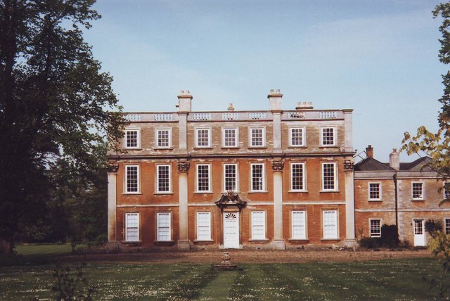
English: Hinwick House, Near Podington, Bedfordshire. The House, not to be confused with the Hall, dates from the 18th Century. It is built with the typical golden sandstone of the region. It is now in the process of restoration. |
||
| Date | |||
| Source | Geograph | ||
| Author | nick macneill | ||
| Permission (Reusing this file) |
This file is licensed under the Creative Commons Attribution-Share Alike 2.0 Generic license. Attribution: nick macneill
|

| Camera location | | View this and other nearby images on: OpenStreetMap |
|---|
_heading:270.00&language=en)
| Object location | | View this and other nearby images on: OpenStreetMap |
|---|
_heading:270.00&language=en)
File history
Click on a date/time to view the file as it appeared at that time.
| Date/Time | Thumbnail | Dimensions | User | Comment | |
|---|---|---|---|---|---|
| current | 18:37, 2 January 2011 | | 640 × 428 (74 KB) | Bogbumper (talk | contribs) | {{Information |Description={{en|1=Hinwick House, Near Podington, Bedfordshire. The House, not to be confused with the Hall, dates from the 18th Century. It is built with the typical golden sandstone of the region. It is now in the process of restoration.} |
You cannot overwrite this file.
File usage on Commons
The following 2 pages use this file:
File usage on other wikis
The following other wikis use this file:
- Usage on dag.wikipedia.org
- Usage on en.wikipedia.org
- Usage on www.wikidata.org