File:Higher Town Bay, St. Martin's - geograph.org.uk - 1196621.jpg
Jump to navigation
Jump to search
No higher resolution available.
Higher_Town_Bay,_St._Martin's_-_geograph.org.uk_-_1196621.jpg (640 × 427 pixels, file size: 48 KB, MIME type: image/jpeg)
Captions
Captions
Add a one-line explanation of what this file represents
Summary
[edit]
| Description |
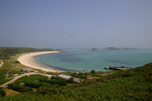
English: Higher Town Bay, St. Martin's Looking east/southeast from the hill behind New Quay. In right foreground, the New Quay, the primary landing point for intra-island trip boats, then the sweep of Higher Town Bay, leading away to Great Ganilly island in the background, on the horizon.
Sorry about prominent grease marks on lens! |
| Date | |
| Source | From geograph.org.uk |
| Author | Graham Loveland |
| Attribution (required by the license) | Graham Loveland / Higher Town Bay, St. Martin's / |
| Camera location | | View this and other nearby images on: OpenStreetMap |
|---|
_heading:90.00&language=en)
| Object location | | View this and other nearby images on: OpenStreetMap |
|---|
_heading:90.00&language=en)
Licensing
[edit]

|
This image was taken from the Geograph project collection. See this photograph's page on the Geograph website for the photographer's contact details. The copyright on this image is owned by Graham Loveland and is licensed for reuse under the Creative Commons Attribution-ShareAlike 2.0 license.
|
This file is licensed under the Creative Commons Attribution-Share Alike 2.0 Generic license.
Attribution: Graham Loveland
- You are free:
- to share – to copy, distribute and transmit the work
- to remix – to adapt the work
- Under the following conditions:
- attribution – You must give appropriate credit, provide a link to the license, and indicate if changes were made. You may do so in any reasonable manner, but not in any way that suggests the licensor endorses you or your use.
- share alike – If you remix, transform, or build upon the material, you must distribute your contributions under the same or compatible license as the original.
File history
Click on a date/time to view the file as it appeared at that time.
| Date/Time | Thumbnail | Dimensions | User | Comment | |
|---|---|---|---|---|---|
| current | 00:20, 26 February 2011 | | 640 × 427 (48 KB) | GeographBot (talk | contribs) | == {{int:filedesc}} == {{Information |description={{en|1=Higher Town Bay, St. Martin's Looking east/southeast from the hill behind New Quay. In right foreground, the New Quay, the primary landing point for intra-island trip boats, then the sweep of Higher |
You cannot overwrite this file.
File usage on Commons
There are no pages that use this file.