File:High Halden Railway Station.jpg
Jump to navigation
Jump to search
No higher resolution available.
High_Halden_Railway_Station.jpg (640 × 480 pixels, file size: 245 KB, MIME type: image/jpeg)
Captions
Captions
Add a one-line explanation of what this file represents
Summary
[edit]
| Description |
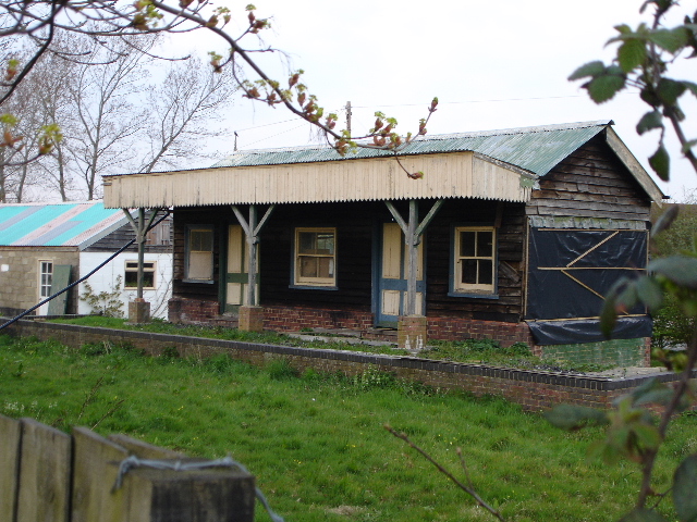
English: Defunct railway station The Rother valley light railway was one of Colonel Stephens 16 light railways. It was started in 1900 from Robertsbridge to Tenterden, extended in 1905 to Headcorn the line was renamed Kent & East Sussex Railway. Services were withdrawn in 1954 and the lines from Tenterden to Headcorn removed. The rest is still a thriving private steam railway. The view is north from the A262 Biddenden road at what is now Applegarth Farm. |
| Date | |
| Source | From geograph.org.uk |
| Author | D-G-Seamon |
| Permission (Reusing this file) |
Creative Commons Attribution Share-alike license 2.0 |
| Attribution (required by the license) | D-G-Seamon / Defunct railway station / |
| Camera location | | View this and other nearby images on: OpenStreetMap |
|---|
| Object location | | View this and other nearby images on: OpenStreetMap |
|---|
_region:GB-ENG_heading:0.00&language=en)
Licensing
[edit]

|
This image was taken from the Geograph project collection. See this photograph's page on the Geograph website for the photographer's contact details. The copyright on this image is owned by D-G-Seamon and is licensed for reuse under the Creative Commons Attribution-ShareAlike 2.0 license.
|
This file is licensed under the Creative Commons Attribution-Share Alike 2.0 Generic license.
Attribution: D-G-Seamon
- You are free:
- to share – to copy, distribute and transmit the work
- to remix – to adapt the work
- Under the following conditions:
- attribution – You must give appropriate credit, provide a link to the license, and indicate if changes were made. You may do so in any reasonable manner, but not in any way that suggests the licensor endorses you or your use.
- share alike – If you remix, transform, or build upon the material, you must distribute your contributions under the same or compatible license as the original.
This file, which was originally posted to
https://www.geograph.org.uk/photo/395669, was reviewed on 18 October 2018 by reviewer Leoboudv, who confirmed that it was available there under the stated license on that date.
|
File history
Click on a date/time to view the file as it appeared at that time.
| Date/Time | Thumbnail | Dimensions | User | Comment | |
|---|---|---|---|---|---|
| current | 21:09, 23 November 2007 | | 640 × 480 (245 KB) | Lamberhurst (talk | contribs) | {{Information |Description=High Halden Railway Station |Source=http://www.geograph.org.uk/photo/395669 |Date=8 April 2007 |Author=D-G Seamon |Permission= |other_versions= }} {{cc-by-2.0}} |
You cannot overwrite this file.
File usage on Commons
The following page uses this file:
File usage on other wikis
The following other wikis use this file:
- Usage on en.wikipedia.org
- Usage on www.wikidata.org