File:Hierve el agua Oaxaca 02.jpg
Jump to navigation
Jump to search

Size of this preview: 800 × 536 pixels. Other resolutions: 320 × 214 pixels | 640 × 428 pixels | 1,024 × 685 pixels | 1,280 × 857 pixels | 2,560 × 1,714 pixels | 3,872 × 2,592 pixels.
Original file (3,872 × 2,592 pixels, file size: 6.95 MB, MIME type: image/jpeg)
Captions
Captions
Add a one-line explanation of what this file represents
Summary
[edit]| Description |
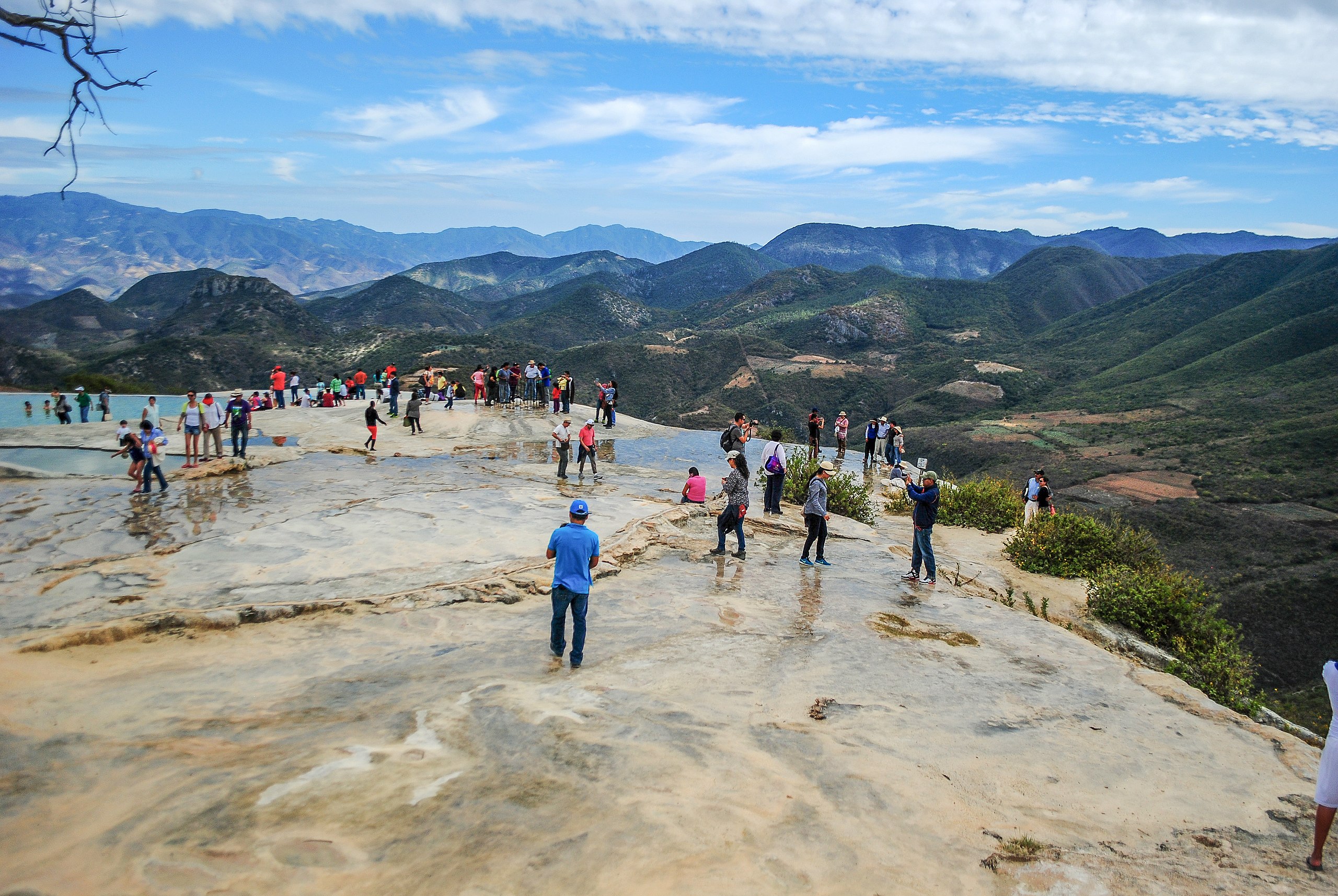
Español: Hierve el Agua es un sistema de cascadas petrificadas, formadas por carbonato de calcio. Las cascadas son de origen natural y se formaron hace miles de años, por el escurrimiento de agua con alto contenido de minerales. El lugar se ubica a unos 50 km de la ciudad de Oaxaca, en la población de San Isidro Roaguía, municipio de San Lorenzo Albarradas, estado de Oaxaca, en México, en las cercanías de la zona arqueológica de Mitla y a 630 km de la Ciudad de México. English: Hierve el Agua (Spanish for "the water boils") is set of natural rock formations in the Mexican state of Oaxaca that resemble cascades of water. The site is located about 70 km east of Oaxaca city, past Mitla, in the municipality of San Lorenzo Albarradas, with a narrow, winding unpaved road leading to the site. The site consists of two rock shelves or cliffs which rise between fifty and ninety metres from the valley below, from which extend nearly white rock formations which look like waterfalls. |
||
| Date | |||
| Source | Own work | ||
| Author | ProtoplasmaKid | ||
| Permission (Reusing this file) |
|

| Camera location | | View this and other nearby images on: OpenStreetMap |
|---|
Licensing
[edit]
I, the copyright holder of this work, hereby publish it under the following license:
This file is licensed under the Creative Commons Attribution-Share Alike 4.0 International license.
- You are free:
- to share – to copy, distribute and transmit the work
- to remix – to adapt the work
- Under the following conditions:
- attribution – You must give appropriate credit, provide a link to the license, and indicate if changes were made. You may do so in any reasonable manner, but not in any way that suggests the licensor endorses you or your use.
- share alike – If you remix, transform, or build upon the material, you must distribute your contributions under the same or compatible license as the original.
File history
Click on a date/time to view the file as it appeared at that time.
| Date/Time | Thumbnail | Dimensions | User | Comment | |
|---|---|---|---|---|---|
| current | 05:41, 20 December 2022 | | 3,872 × 2,592 (6.95 MB) | ProtoplasmaKid (talk | contribs) | Color, focus and geometric distortion corrected |
| 19:47, 26 December 2014 |  | 3,872 × 2,592 (4.4 MB) | ProtoplasmaKid (talk | contribs) | User created page with UploadWizard |
You cannot overwrite this file.
File usage on Commons
The following page uses this file: