File:Hierosolyma, vrbs sancta. Ivdeae, totivsove Orientis longe clarissima, qva amplitvdine ac magnificentia hoc nostro aevo conspicva est.jpg
Jump to navigation
Jump to search
Size of this preview: 798 × 600 pixels. Other resolutions: 319 × 240 pixels | 639 × 480 pixels | 1,022 × 768 pixels | 1,280 × 962 pixels | 2,065 × 1,552 pixels.
Original file (2,065 × 1,552 pixels, file size: 798 KB, MIME type: image/jpeg)
Captions
Captions
Add a one-line explanation of what this file represents
Summary
[edit]| Description |
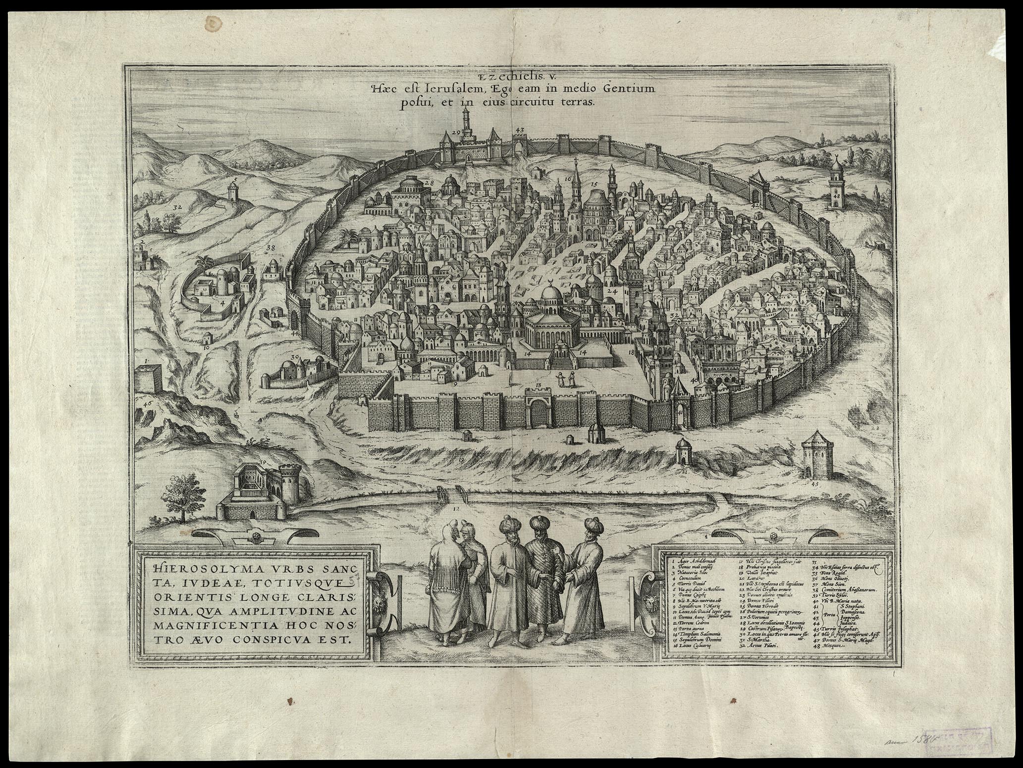
English: Jerusalem, the Holy City, by far the most famous city of Juda and the East in her present size and greatness. From the German edition of Braun and Hogenberg, Civitates Orbis Terrarum, 1576.
עברית: ירושלים, העיר הקדושה, העיר המפורסמת בערי יהודה והמזרח. מראה ירושלים המודרנית מן המזרח. מתוך מהדורה גרמנית של ספרם של בראון והוגנברג - ערי כדור הארץ, 1576.
Dimensions:324x413mm Click to enlarge. |
|||
| Date | ||||
| Source | The Eran Laor Cartographic Collection, National Library of Israel | |||
| Author | The National Library of Israel |


Licensing
[edit]
|
This work is in the public domain in its country of origin and other countries and areas where the copyright term is the author's life plus 70 years or fewer. | |
| This file has been identified as being free of known restrictions under copyright law, including all related and neighboring rights. | |
File history
Click on a date/time to view the file as it appeared at that time.
| Date/Time | Thumbnail | Dimensions | User | Comment | |
|---|---|---|---|---|---|
| current | 13:36, 15 December 2015 | | 2,065 × 1,552 (798 KB) | National Library of Israel (talk | contribs) |
You cannot overwrite this file.
File usage on Commons
The following 3 pages use this file: