File:HessianMapMudIsland.jpg
Jump to navigation
Jump to search

Size of this preview: 441 × 600 pixels. Other resolutions: 176 × 240 pixels | 353 × 480 pixels | 565 × 768 pixels | 753 × 1,024 pixels | 1,506 × 2,048 pixels | 2,580 × 3,508 pixels.
Original file (2,580 × 3,508 pixels, file size: 1.43 MB, MIME type: image/jpeg)
Captions
Captions
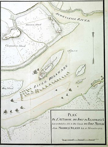
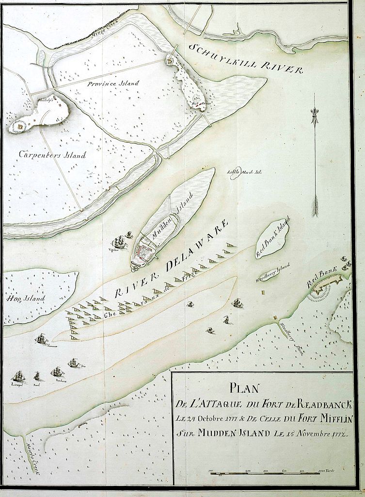
Map of the Delaware River, Fort Mifflin, Philadelphia and vicinity, 1777
| Description |
18th century Hessian map showing the 1777 Philadelphia campaign. Moved from en.wikipedia.org. Originally from Marburg State Library via West Jersey History Project [1] |
|||||||||
| Geotemporal data | ||||||||||
| Bounding box |
|
|||||||||
| Georeferencing | ||||||||||
|
This work is in the public domain in its country of origin and other countries and areas where the copyright term is the author's life plus 100 years or fewer. | |
| This file has been identified as being free of known restrictions under copyright law, including all related and neighboring rights. | |
Other versions of 1777 maps depicting the Delaware River, Fort Mifflin, Philadelphia and vicinity:
 |
 |
 |
 |
File history
Click on a date/time to view the file as it appeared at that time.
| Date/Time | Thumbnail | Dimensions | User | Comment | |
|---|---|---|---|---|---|
| current | 01:19, 22 December 2012 | | 2,580 × 3,508 (1.43 MB) | Боцман (talk | contribs) | 18th century Hessian map showing the 1777 Philadelphia campaign. Moved from en.wikipedia.org. Originally from Marburg State Library via West Jersey History Project [http://westjerseyhistory.org/maps/revwarmaps/hessianmaps/] {{PD-old-100}} [[Category:M... |
You cannot overwrite this file.
File usage on Commons
The following 4 pages use this file:
File usage on other wikis
The following other wikis use this file:
- Usage on en.wikipedia.org
- Usage on es.wikipedia.org
- Usage on fr.wikipedia.org
- Usage on he.wikipedia.org
- Usage on ja.wikipedia.org
- Usage on nl.wikipedia.org
- Usage on ru.wikipedia.org
- Usage on www.wikidata.org