File:Herttoniemi1856.jpg
Jump to navigation
Jump to search
No higher resolution available.
Herttoniemi1856.jpg (345 × 362 pixels, file size: 91 KB, MIME type: image/jpeg)
Captions
Captions
Add a one-line explanation of what this file represents
| Description |
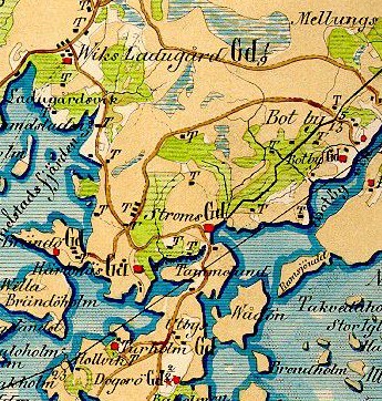
English: Part of a map from Kalmberg's Maps. This map covers East Helsinki, Finland.
Suomi: Itä-Helsinki Kalmbergin kartaston kartassa vuodelta 1856. |
|||||||||
| Date | ||||||||||
| Source | Finnish Wikipedia | |||||||||
| Creator |
Gustaf Adolf Kalmberg |
|||||||||
| Permission (Reusing this file) |
|
|||||||||
| Geotemporal data | ||||||||||
| Bounding box |
|
|||||||||
| Georeferencing | ||||||||||
File history
Click on a date/time to view the file as it appeared at that time.
| Date/Time | Thumbnail | Dimensions | User | Comment | |
|---|---|---|---|---|---|
| current | 21:47, 18 August 2010 | | 345 × 362 (91 KB) | Arkkipuudeli (talk | contribs) | {{Information |Description=Part of a map from ''Kalmberg's Maps'' |Source=Finnish Wikipedia |Date=1856 |Author=Gustaf Adolf Kalmberg |Permission={{PD-old-70}} |other_versions= }} Category:Maps of Helsinki |
You cannot overwrite this file.
File usage on Commons
There are no pages that use this file.
File usage on other wikis
The following other wikis use this file:
- Usage on en.wikipedia.org
- Usage on fi.wikipedia.org