File:Hendricks canal in Butte County.jpg
Jump to navigation
Jump to search

Size of this preview: 800 × 450 pixels. Other resolutions: 320 × 180 pixels | 640 × 360 pixels | 1,024 × 576 pixels | 1,280 × 720 pixels | 2,560 × 1,440 pixels | 5,649 × 3,178 pixels.
Original file (5,649 × 3,178 pixels, file size: 20.17 MB, MIME type: image/jpeg)
Captions
Captions
Add a one-line explanation of what this file represents
Summary[edit]
| Description |
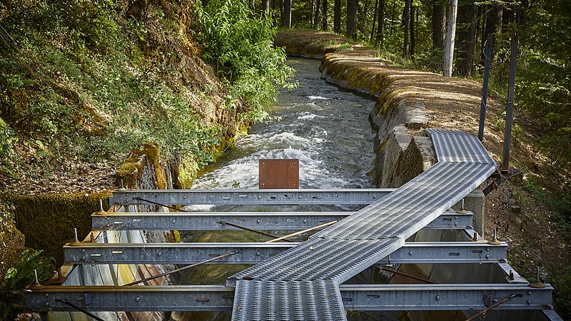
English: Hendricks canal near DeSabla, Butte County, California, on June 14, 2020. The canal came under the ownership of PG&E in 1908. It serves the power plant built in DeSabla in 1903. Hendricks canal discharges into the Butte Creek canal about a mile above the DeSabla reservoir. The canal is 103,473 feet long and comprises 93,563 feet of ditch, 7,806 feet of flume, and 2,104 feet of tunnel. The original stretch of the canal, 12.3 miles long, was built about 1871 to a ravine a mile southwest of Stirling City, where it was used for hydraulic mining. When hydraulic mining was stopped, Hendricks canal was abandoned for a few years, but in the summer of 1905 it was cleaned out and extended to its present length. (Lit. Frederick Hall Fowler, Hydroelectric Power Systems of California, Washington 1923, p. 207). |
| Date | |
| Source | Own work |
| Author | Frank Schulenburg |
| Camera location | | View this and other nearby images on: OpenStreetMap |
|---|
Licensing[edit]
I, the copyright holder of this work, hereby publish it under the following license:
This file is licensed under the Creative Commons Attribution-Share Alike 4.0 International license.
- You are free:
- to share – to copy, distribute and transmit the work
- to remix – to adapt the work
- Under the following conditions:
- attribution – You must give appropriate credit, provide a link to the license, and indicate if changes were made. You may do so in any reasonable manner, but not in any way that suggests the licensor endorses you or your use.
- share alike – If you remix, transform, or build upon the material, you must distribute your contributions under the same or compatible license as the original.
This image has been assessed using the Quality image guidelines and is considered a Quality image.
|
File history
Click on a date/time to view the file as it appeared at that time.
| Date/Time | Thumbnail | Dimensions | User | Comment | |
|---|---|---|---|---|---|
| current | 16:03, 15 June 2020 | | 5,649 × 3,178 (20.17 MB) | Frank Schulenburg (talk | contribs) | Brightened |
| 15:54, 15 June 2020 |  | 5,649 × 3,178 (19.36 MB) | Frank Schulenburg (talk | contribs) | Uploaded own work with UploadWizard |
You cannot overwrite this file.
File usage on Commons
The following 6 pages use this file:
- User:Frank Schulenburg/Gallery
- Commons:Photo challenge/2020 - June - Rainwater drainage
- Commons:Photo challenge/2020 - June - Rainwater drainage/Voting
- Commons:Photo challenge/2020 - June - Rainwater drainage/Voting/Result
- Commons:Quality images/Subject/Places/Man made structures
- Commons:Quality images candidates/Archives June 24 2020