File:Hemdean Bottom area - geograph.org.uk - 347627.jpg
Jump to navigation
Jump to search
No higher resolution available.
Hemdean_Bottom_area_-_geograph.org.uk_-_347627.jpg (640 × 477 pixels, file size: 80 KB, MIME type: image/jpeg)
Captions
Captions
Add a one-line explanation of what this file represents
Summary
[edit]
| Description |
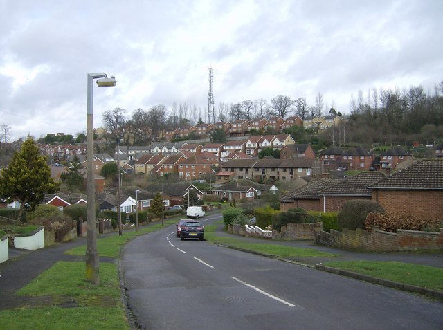
English: Hemdean Bottom area A lot of controversy locally as new houses (mainly the white ones in this picture) were built up the sides of a green coombe known locally as Bugs Bottom (but shown on most maps as Hemdean Bottom). Those houses, and the communications tower, are in SU7176, although the photographer and everything up to the last bungalow are in SU7076. |
| Date | |
| Source | From geograph.org.uk |
| Author | Graham Horn |
| Attribution (required by the license) | Graham Horn / Hemdean Bottom area / |
| Camera location | | View this and other nearby images on: OpenStreetMap |
|---|
_heading:22.00&language=en)
| Object location | | View this and other nearby images on: OpenStreetMap |
|---|
_heading:22.00&language=en)
Licensing
[edit]

|
This image was taken from the Geograph project collection. See this photograph's page on the Geograph website for the photographer's contact details. The copyright on this image is owned by Graham Horn and is licensed for reuse under the Creative Commons Attribution-ShareAlike 2.0 license.
|
This file is licensed under the Creative Commons Attribution-Share Alike 2.0 Generic license.
Attribution: Graham Horn
- You are free:
- to share – to copy, distribute and transmit the work
- to remix – to adapt the work
- Under the following conditions:
- attribution – You must give appropriate credit, provide a link to the license, and indicate if changes were made. You may do so in any reasonable manner, but not in any way that suggests the licensor endorses you or your use.
- share alike – If you remix, transform, or build upon the material, you must distribute your contributions under the same or compatible license as the original.
File history
Click on a date/time to view the file as it appeared at that time.
| Date/Time | Thumbnail | Dimensions | User | Comment | |
|---|---|---|---|---|---|
| current | 17:15, 2 January 2011 | | 640 × 477 (80 KB) | GeographBot (talk | contribs) | == {{int:filedesc}} == {{Information |description={{en|1=Hemdean Bottom area A lot of controversy locally as new houses (mainly the white ones in this picture) were built up the sides of a green coombe known locally as Bugs Bottom (but shown on most maps |
You cannot overwrite this file.
File usage on Commons
There are no pages that use this file.