File:Hayes & Harlington station geograph-3624494-by-Ben-Brooksbank.jpg
Jump to navigation
Jump to search

Size of this preview: 800 × 447 pixels. Other resolutions: 320 × 179 pixels | 640 × 358 pixels | 1,024 × 573 pixels | 1,280 × 716 pixels | 2,299 × 1,286 pixels.
Original file (2,299 × 1,286 pixels, file size: 2.38 MB, MIME type: image/jpeg)
Captions
Captions
Add a one-line explanation of what this file represents
Summary
[edit]
| Description |
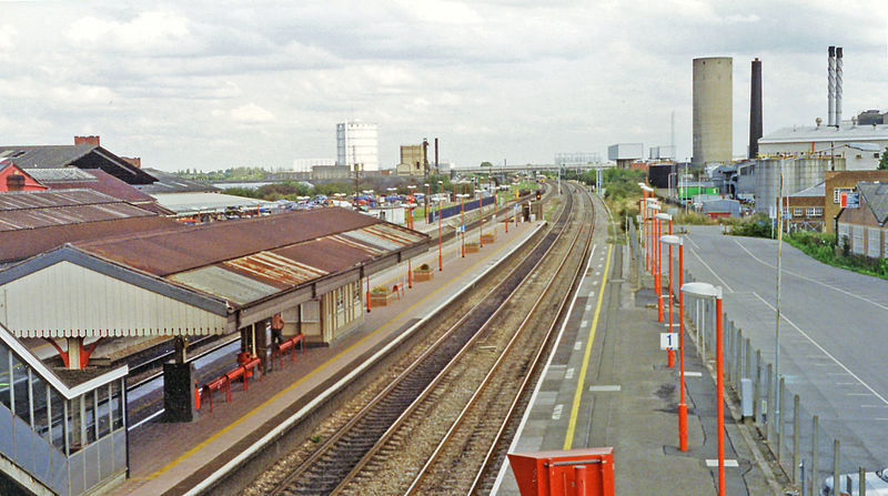
English: Hayes & Harlington station, 1994. View eastward, towards London: ex-GWR Paddington - Reading etc., etc. main line. The view is along the Fast line platforms, most trains stopping using the Relief lines on the left. The tower on the right was probably a cereal silo for the Nestlés factory and in the left distance is the enormous gas-holder of North Thames Gas at Southall. |
| Date | |
| Source | From geograph.org.uk |
| Author | Ben Brooksbank |
| Permission (Reusing this file) |
Creative Commons Attribution Share-alike license 2.0 |
| Attribution (required by the license) | Ben Brooksbank / Hayes & Harlington station, 1994 / |
| Camera location | | View this and other nearby images on: OpenStreetMap |
|---|
Licensing
[edit]

|
This image was taken from the Geograph project collection. See this photograph's page on the Geograph website for the photographer's contact details. The copyright on this image is owned by Ben Brooksbank and is licensed for reuse under the Creative Commons Attribution-ShareAlike 2.0 license.
|
This file is licensed under the Creative Commons Attribution-Share Alike 2.0 Generic license.
Attribution: Ben Brooksbank
- You are free:
- to share – to copy, distribute and transmit the work
- to remix – to adapt the work
- Under the following conditions:
- attribution – You must give appropriate credit, provide a link to the license, and indicate if changes were made. You may do so in any reasonable manner, but not in any way that suggests the licensor endorses you or your use.
- share alike – If you remix, transform, or build upon the material, you must distribute your contributions under the same or compatible license as the original.
File history
Click on a date/time to view the file as it appeared at that time.
| Date/Time | Thumbnail | Dimensions | User | Comment | |
|---|---|---|---|---|---|
| current | 10:09, 28 September 2013 | | 2,299 × 1,286 (2.38 MB) | Chevin (talk | contribs) | {{Information |Description ={{en|1={{geograph|3624494|Ben Brooksbank}}}} |Source ={{geograph|3624494|Ben Brooksbank}} |Author ={{geograph|3624494|Ben Brooksbank}} |Date = |Permission = |other_versions = }} |
You cannot overwrite this file.
File usage on Commons
The following page uses this file:
File usage on other wikis
The following other wikis use this file:
- Usage on en.wikipedia.org