File:Hatton Coffee factory 076980 72c7b4d5.jpg
Jump to navigation
Jump to search
No higher resolution available.
Hatton_Coffee_factory_076980_72c7b4d5.jpg (640 × 480 pixels, file size: 20 KB, MIME type: image/jpeg)
Captions
Captions
Add a one-line explanation of what this file represents
Summary
[edit]
| Description |
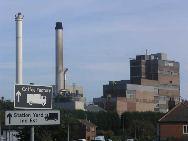
English: Nestle coffee factory, Hatton As the road sign says, this is the Nestle coffee factory in the Derbyshire village of Hatton. |
| Date | |
| Source | From geograph.org.uk |
| Author | Simon Johnson |
| Camera location | | View this and other nearby images on: OpenStreetMap |
|---|
Licensing
[edit]

|
This image was taken from the Geograph project collection. See this photograph's page on the Geograph website for the photographer's contact details. The copyright on this image is owned by Simon Johnson and is licensed for reuse under the Creative Commons Attribution-ShareAlike 2.0 license.
|
This file is licensed under the Creative Commons Attribution-Share Alike 2.0 Generic license.
Attribution: Simon Johnson
- You are free:
- to share – to copy, distribute and transmit the work
- to remix – to adapt the work
- Under the following conditions:
- attribution – You must give appropriate credit, provide a link to the license, and indicate if changes were made. You may do so in any reasonable manner, but not in any way that suggests the licensor endorses you or your use.
- share alike – If you remix, transform, or build upon the material, you must distribute your contributions under the same or compatible license as the original.
File history
Click on a date/time to view the file as it appeared at that time.
| Date/Time | Thumbnail | Dimensions | User | Comment | |
|---|---|---|---|---|---|
| current | 18:35, 1 April 2008 | | 640 × 480 (20 KB) | Victuallers (talk | contribs) | {{Information |Description=Hilton Coffee factory Drebyshire. OSGB36: geotagged! SK 214 296 [100m precision] WGS84: 52:51.8078N 1:41.0146W |Source=http://www.geograph.org.uk/photo/76980 |Date=12 Nov 2005 |Author=Si |
You cannot overwrite this file.
File usage on Commons
The following page uses this file:
File usage on other wikis
The following other wikis use this file:
- Usage on ceb.wikipedia.org
- Usage on cy.wikipedia.org
- Usage on en.wikipedia.org
- Usage on es.wikipedia.org
- Usage on fa.wikipedia.org
- Usage on fr.wikipedia.org
- Usage on it.wikipedia.org
- Usage on lld.wikipedia.org
- Usage on pl.wikipedia.org
- Usage on www.wikidata.org