File:Harrison Township near Crooksville Airport.jpg
Jump to navigation
Jump to search

Size of this preview: 800 × 450 pixels. Other resolutions: 320 × 180 pixels | 640 × 360 pixels | 1,024 × 576 pixels | 1,280 × 720 pixels | 2,816 × 1,584 pixels.
Original file (2,816 × 1,584 pixels, file size: 953 KB, MIME type: image/jpeg)
Captions
Captions
Add a one-line explanation of what this file represents
| Camera location | | View this and other nearby images on: OpenStreetMap |
|---|
| Description |
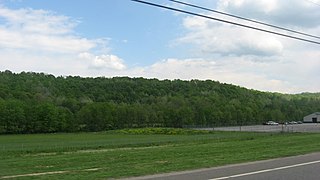
English: Fields and hills south of Crooksville in southern Harrison Township, Perry County, Ohio, United States. The scene is immediately north of the Crooksville Airport, and the picture is taken from a southbound car on State Route 93. |
||
| Date | Taken on 13 May 2013 | ||
| Source | Own work | ||
| Author | Nyttend | ||
| Permission (Reusing this file) |
|
File history
Click on a date/time to view the file as it appeared at that time.
| Date/Time | Thumbnail | Dimensions | User | Comment | |
|---|---|---|---|---|---|
| current | 17:40, 19 May 2013 | | 2,816 × 1,584 (953 KB) | Nyttend (talk | contribs) | {{Location|39|44|14|N|82|5|59|W}} {{Information |Description={{en|Fields and hills south of {{w|Crooksville, Ohio|Crooksville}} in southern {{w|Harrison Township, Perry County, Ohio|Harrison Township}}, {{w|Perry County, Ohio|Perry County}}, {{w|Ohio}}... |
You cannot overwrite this file.
File usage on Commons
The following page uses this file:
File usage on other wikis
The following other wikis use this file:
- Usage on en.wikipedia.org
- Usage on es.wikipedia.org
- Usage on eu.wikipedia.org
- Usage on fa.wikipedia.org
- Usage on pt.wikipedia.org
- Usage on ur.wikipedia.org
- Usage on vi.wikipedia.org
- Usage on www.wikidata.org
- Usage on zh.wikipedia.org