File:Harlow, Railway footbridge - geograph.org.uk - 1467073.jpg
Jump to navigation
Jump to search
No higher resolution available.
Harlow,_Railway_footbridge_-_geograph.org.uk_-_1467073.jpg (640 × 480 pixels, file size: 103 KB, MIME type: image/jpeg)
Captions
Captions
Add a one-line explanation of what this file represents
Summary
[edit]
| Description |
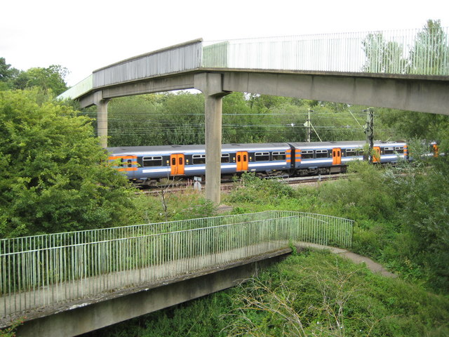
English: Harlow: Railway footbridge This high and slender concrete footbridge over the railway is about 400 metres east of Harlow Town station, and is approached by a V-shaped ramp on either side. It follows the route of a right of way that existed before the railway was built, between the town and the canal. An airport-bound Stansted Express train hurtles by underneath. Although the train is a franchise operated by National Express, is not the livery a hint in the direction of EasyJet? |
| Date | |
| Source | From geograph.org.uk |
| Author | Nigel Cox |
| Attribution (required by the license) | Nigel Cox / Harlow: Railway footbridge / |
| Camera location | | View this and other nearby images on: OpenStreetMap |
|---|
_heading:0.00&language=en)
| Object location | | View this and other nearby images on: OpenStreetMap |
|---|
_heading:0.00&language=en)
Licensing
[edit]

|
This image was taken from the Geograph project collection. See this photograph's page on the Geograph website for the photographer's contact details. The copyright on this image is owned by Nigel Cox and is licensed for reuse under the Creative Commons Attribution-ShareAlike 2.0 license.
|
This file is licensed under the Creative Commons Attribution-Share Alike 2.0 Generic license.
Attribution: Nigel Cox
- You are free:
- to share – to copy, distribute and transmit the work
- to remix – to adapt the work
- Under the following conditions:
- attribution – You must give appropriate credit, provide a link to the license, and indicate if changes were made. You may do so in any reasonable manner, but not in any way that suggests the licensor endorses you or your use.
- share alike – If you remix, transform, or build upon the material, you must distribute your contributions under the same or compatible license as the original.
File history
Click on a date/time to view the file as it appeared at that time.
| Date/Time | Thumbnail | Dimensions | User | Comment | |
|---|---|---|---|---|---|
| current | 08:38, 2 March 2011 | | 640 × 480 (103 KB) | GeographBot (talk | contribs) | == {{int:filedesc}} == {{Information |description={{en|1=Harlow: Railway footbridge This high and slender concrete footbridge over the railway is about 400 metres east of Harlow Town station, and is approached by a V-shaped ramp on either side. It follows |
You cannot overwrite this file.
File usage on Commons
There are no pages that use this file.