File:Hanau-Karte-Innenstadt-1932.png

Original file (1,489 × 2,000 pixels, file size: 728 KB, MIME type: image/png)
Captions
Captions
| DescriptionHanau-Karte-Innenstadt-1932.png | Karte der Stadt Hanau aus dem Jahre 1932 | ||||||
| Date | |||||||
| Source | Bearbeitung einer Abbildung (Karte Nr. 4) aus: Wolf, Gustav: Die Stadt Hanau am Main geographisch betrachtet. In: Schrepfer, Hans (Hg.) Rhein-Mainische Forschungen Heft 6, Frankfurt 1932. | ||||||
| Author | Vermutl. Gustav Wolf. Hochgeladen und überarbeitet von David Liuzzo. | ||||||
| Permission (Reusing this file) |
|
||||||
| Annotations InfoField | This image is annotated: View the annotations at Commons |


Neustädter Markt mit dem Nationaldenkmal der Brüder Grimm
Johanneskirche
Ehemaliger Standort des Steinheimer Tors
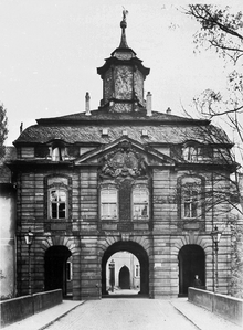
Vormals befestigte Hanauer Vorstadt (Stadterweiterung 16. Jh.) mit Kinzigbrücke
Kreisamt des (Alt-)Kreises Hanau
Jüdische Synagoge; im Dritten Reich zerstört
Standort der einstigen Siedlung Kinzdorf
Heumarkt
Stadtschloss (Marstall, später Stadthalle)
Stadtschloss (Kanzleigebäude)
Stadtsparkasse - Am Markt 14
Am Markt 10
Am Markt 12
Am Markt 18
Am Markt 20
Am Markt 9
Am Markt 7
Am Markt 6
Am Markt 4
Am Markt 2
Am Markt 8
Am Markt 15
Schloßplatz
Am Markt 3
Am Markt 1
Paradeplatz (Esplanade)
Hanau Nordbahnhof
Hanau Westbahnhof Richtung Frankfurt über Wilhelmsbad, Dörnigheim-Hochstadt, Bischofsheim, Mainkur, FfM Ostbahnhof, FfM Südbahnhof nach FfM Hauptbahnhof.
Post
Schlossgarten
Straßenbahndepot
Wilhelmsbrücke
Eberhardschule
Jahnhalle
File history
Click on a date/time to view the file as it appeared at that time.
| Date/Time | Thumbnail | Dimensions | User | Comment | |
|---|---|---|---|---|---|
| current | 03:11, 2 January 2010 |  | 1,489 × 2,000 (728 KB) | David Liuzzo (talk | contribs) | (Ackerflächen Eingefärbt) |
| 05:04, 24 December 2009 |  | 1,489 × 2,000 (3.84 MB) | David Liuzzo (talk | contribs) | Grünflächen und Gewässer eingefärbt | |
| 16:48, 23 December 2009 |  | 1,489 × 2,000 (1.01 MB) | David Liuzzo (talk | contribs) | {{Information |Description=Karte der Stadt Hanau aus dem Jahre 1932 |Source= Bearbeitung einer Abbildung aus: Wolf, Gustav: Die Stadt Hanau am Main geographisch betrachtet. In: Schrepfer, Hans (Hg.) Rhein-Mainische Forschungen Heft 6, Frankfurt 1932. |Dat |
You cannot overwrite this file.
File usage on Commons
The following page uses this file:
File usage on other wikis
The following other wikis use this file:
- Usage on de.wikipedia.org
- Usage on fr.wikipedia.org


