File:Hampstead Garden Suburb Free Church - geograph.org.uk - 359582.jpg
Jump to navigation
Jump to search
No higher resolution available.
Hampstead_Garden_Suburb_Free_Church_-_geograph.org.uk_-_359582.jpg (640 × 480 pixels, file size: 105 KB, MIME type: image/jpeg)
Captions
Captions
Add a one-line explanation of what this file represents
Summary
[edit]
| Description |
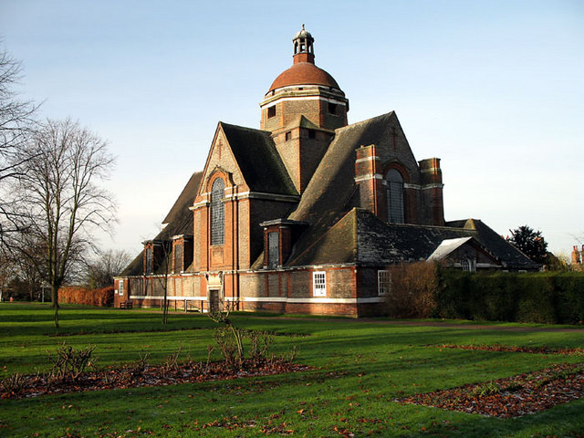
English: Hampstead Garden Suburb Free Church, near to Golders Green, Barnet, Great Britain.
One of two large churches on Central Square, the Free Church is less well known than its companion, St.Jude-on-the-Hill - probably because St.Jude's spire can be seen from many miles around. Its shadow can be seen on the roof of the Free Church in this photograph. Both churches were designed by Edwin Lutyens. Work on the Free Church commenced in 1911, was completed and consecrated the same year. (St.Jude's, begun in 1909 and consecrated in 1911, was finally completed in 1935). |
| Date | |
| Source | From geograph.org.uk; transferred by User:Kurpfalzbilder.de using geograph_org2commons. |
| Author | Martin Addison |
| Permission (Reusing this file) |
Creative Commons Attribution Share-alike license 2.0 |
| Attribution (required by the license) | Martin Addison / Hampstead Garden Suburb Free Church / |
| Camera location | | View this and other nearby images on: OpenStreetMap |
|---|
| Object location | | View this and other nearby images on: OpenStreetMap |
|---|
_region:GB-GBN_heading:270.00&language=en)
Licensing
[edit]

|
This image was taken from the Geograph project collection. See this photograph's page on the Geograph website for the photographer's contact details. The copyright on this image is owned by Martin Addison and is licensed for reuse under the Creative Commons Attribution-ShareAlike 2.0 license.
|
This file is licensed under the Creative Commons Attribution-Share Alike 2.0 Generic license.
Attribution: Martin Addison
- You are free:
- to share – to copy, distribute and transmit the work
- to remix – to adapt the work
- Under the following conditions:
- attribution – You must give appropriate credit, provide a link to the license, and indicate if changes were made. You may do so in any reasonable manner, but not in any way that suggests the licensor endorses you or your use.
- share alike – If you remix, transform, or build upon the material, you must distribute your contributions under the same or compatible license as the original.
File history
Click on a date/time to view the file as it appeared at that time.
| Date/Time | Thumbnail | Dimensions | User | Comment | |
|---|---|---|---|---|---|
| current | 11:48, 9 September 2010 | | 640 × 480 (105 KB) | File Upload Bot (Magnus Manske) (talk | contribs) | == {{int:filedesc}} == {{Information |Description={{en|1=Hampstead Garden Suburb Free Church, near to Golders Green, Barnet, Great Britain. One of two large churches on Central Square, the Free Church is less well known than its companion, St.Jude-on-the- |
You cannot overwrite this file.
File usage on Commons
There are no pages that use this file.