File:Hamburger Hochbahn - Plan der Linie U2.png
Jump to navigation
Jump to search

Size of this preview: 724 × 599 pixels. Other resolutions: 290 × 240 pixels | 580 × 480 pixels | 928 × 768 pixels | 1,237 × 1,024 pixels | 2,415 × 1,999 pixels.
Original file (2,415 × 1,999 pixels, file size: 348 KB, MIME type: image/png)
Captions
Captions
Add a one-line explanation of what this file represents
Summary
[edit]| Description |
|
| Date | see file history |
| Source |
Self made, using the information from
and using the following graphic: Created with Adobe Illustrator 13.0 If you ask for, I will give you the .ai-file or I'll correct it or create other language versions. |
| Author | Maximilian Dörrbecker (Chumwa) |
| Permission (Reusing this file) |
I, the copyright holder of this work, hereby publish it under the following license: This file is licensed under the Creative Commons Attribution-Share Alike 2.5 Generic license.
Sie dürfen das Bild zu den folgenden Bedingungen nutzen:
|
| Other versions |
|

.png)


File history
Click on a date/time to view the file as it appeared at that time.
| Date/Time | Thumbnail | Dimensions | User | Comment | |
|---|---|---|---|---|---|
| current | 10:14, 12 March 2022 | | 2,415 × 1,999 (348 KB) | NordNordWest (talk | contribs) | update (U4 extension) |
| 20:31, 21 June 2017 |  | 2,415 × 1,999 (522 KB) | Chumwa (talk | contribs) | update (U4 extension) | |
| 14:34, 26 October 2009 |  | 1,537 × 1,261 (258 KB) | MeBa 2000 (talk | contribs) | de: weiße Ränder entfernt en: cut off white borders | |
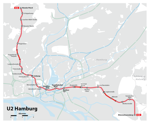
| 07:09, 5 July 2009 |  | 1,610 × 1,332 (316 KB) | Chumwa (talk | contribs) | {{Information |Description= *{{ de }} Karte der Linie U2 der Hamburger Hochbahn *{{ en }} Map of Hochbahn Hamburg route U2 |Source=Self made, using the information from * de:Hamburger Hochbahn * de:U-Bahn Hamburg (from [http://de.wikipedia.org/w |
You cannot overwrite this file.
File usage on Commons
The following 18 pages use this file:
- User:Chumwa/Gallery
- User:Chumwa/OgreBot/Potential transport maps/2017 June 21-30
- User:Chumwa/OgreBot/Public transport information/2017 June 21-30
- User:Chumwa/OgreBot/Public transport information/2022 March 11-20
- User:Chumwa/OgreBot/Transport Maps/2017 June 21-30
- User:Chumwa/OgreBot/Transport Maps/2022 March 11-20
- User:Chumwa/OgreBot/Travel and communication maps/2017 June 21-30
- User:Clic/Nahverkehr in Deutschland/2022 March 11-20
- File:Hamburger Hochbahn - Entwicklungsgeschichte.png
- File:Hamburger Hochbahn - Linienplan.png
- File:Hamburger Hochbahn - Linienplan (mit Tunnels).png
- File:Hamburger Hochbahn - Plan der Linie U1.png
- File:Hamburger Hochbahn - Plan der Linie U2.png
- File:Hamburger Hochbahn - Plan der Linie U2 bis 2009.png
- File:Hamburger Hochbahn - Plan der Linie U3.png
- File:Hamburger Hochbahn - Plan der Linie U3 bis 2009.png
- File:Hamburger Hochbahn - Plan der Linie U4.png
- Category:U-Bahnlinie U2 (Hamburg)
File usage on other wikis
The following other wikis use this file:
- Usage on ar.wikipedia.org
- Usage on ca.wikipedia.org
- Usage on de.wikipedia.org
- Usage on en.wikipedia.org
- Usage on fr.wikipedia.org
- Billstedt (métro de Hambourg)
- Horner Rennbahn (métro de Hambourg)
- Messehallen (métro de Hambourg)
- Schlump (métro de Hambourg)
- Hagenbecks Tierpark (métro de Hambourg)
- Niendorf Nord (métro de Hambourg)
- Gare de Hambourg-Jungfernstieg
- Rauhes Haus (métro de Hambourg)
- Mümmelmannsberg (métro de Hambourg)
- Gänsemarkt (métro de Hambourg)
- Osterstraße (métro de Hambourg)
- Lutterothstraße (métro de Hambourg)
- Usage on it.wikipedia.org
- Usage on nl.wikipedia.org
- Usage on sv.wikipedia.org
- Usage on www.wikidata.org