File:Hamburg-Kleiner Grasbrook OSM 2015.svg
Jump to navigation
Jump to search

Size of this PNG preview of this SVG file: 800 × 574 pixels. Other resolutions: 320 × 230 pixels | 640 × 460 pixels | 1,024 × 735 pixels | 1,280 × 919 pixels | 2,560 × 1,838 pixels | 2,171 × 1,559 pixels.
Original file (SVG file, nominally 2,171 × 1,559 pixels, file size: 6.03 MB)
Captions
Captions
Add a one-line explanation of what this file represents
| Description |
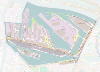
Map of Hamburg-Kleiner Grasbrook, Germany This map of Hamburg-Kleiner Grasbrook was created from OpenStreetMap project data, collected by the community. This map may be incomplete, and may contain errors. Don't rely solely on it for navigation. |
|||
| Date | ||||
| Source | You may find a page on the OpenStreetMap wiki page for Hamburg-Kleiner Grasbrook | |||
| Creator |
OpenStreetMap contributors |
|||
| Permission (Reusing this file) |
OpenStreetMap data is available under the Open Database License (details). Map tiles are licensed under the Creative Commons Attribution-ShareAlike 2.0 license (CC-BY-SA 2.0).
This file is licensed under the Creative Commons Attribution-Share Alike 2.0 Generic license.
|
File history
Click on a date/time to view the file as it appeared at that time.
| Date/Time | Thumbnail | Dimensions | User | Comment | |
|---|---|---|---|---|---|
| current | 11:07, 17 March 2015 | | 2,171 × 1,559 (6.03 MB) | Flor!an (talk | contribs) | {{OpenStreetMap| | name = Hamburg-Kleiner Grasbrook | location = Hamburg-Kleiner Grasbrook | description = Map of Hamburg-Kleiner Grasbrook, Germany | top = | bottom = | left = | right = | da... |
You cannot overwrite this file.
File usage on Commons
There are no pages that use this file.
File usage on other wikis
The following other wikis use this file:
- Usage on de.wikipedia.org
- Usage on nl.wikipedia.org