File:Halsey Old NY Frontier Patent Map.png
Jump to navigation
Jump to search
Size of this preview: 676 × 600 pixels. Other resolutions: 271 × 240 pixels | 541 × 480 pixels | 866 × 768 pixels | 1,154 × 1,024 pixels | 2,309 × 2,048 pixels | 4,589 × 4,071 pixels.
Original file (4,589 × 4,071 pixels, file size: 1.77 MB, MIME type: image/png)
Captions
Captions
Add a one-line explanation of what this file represents
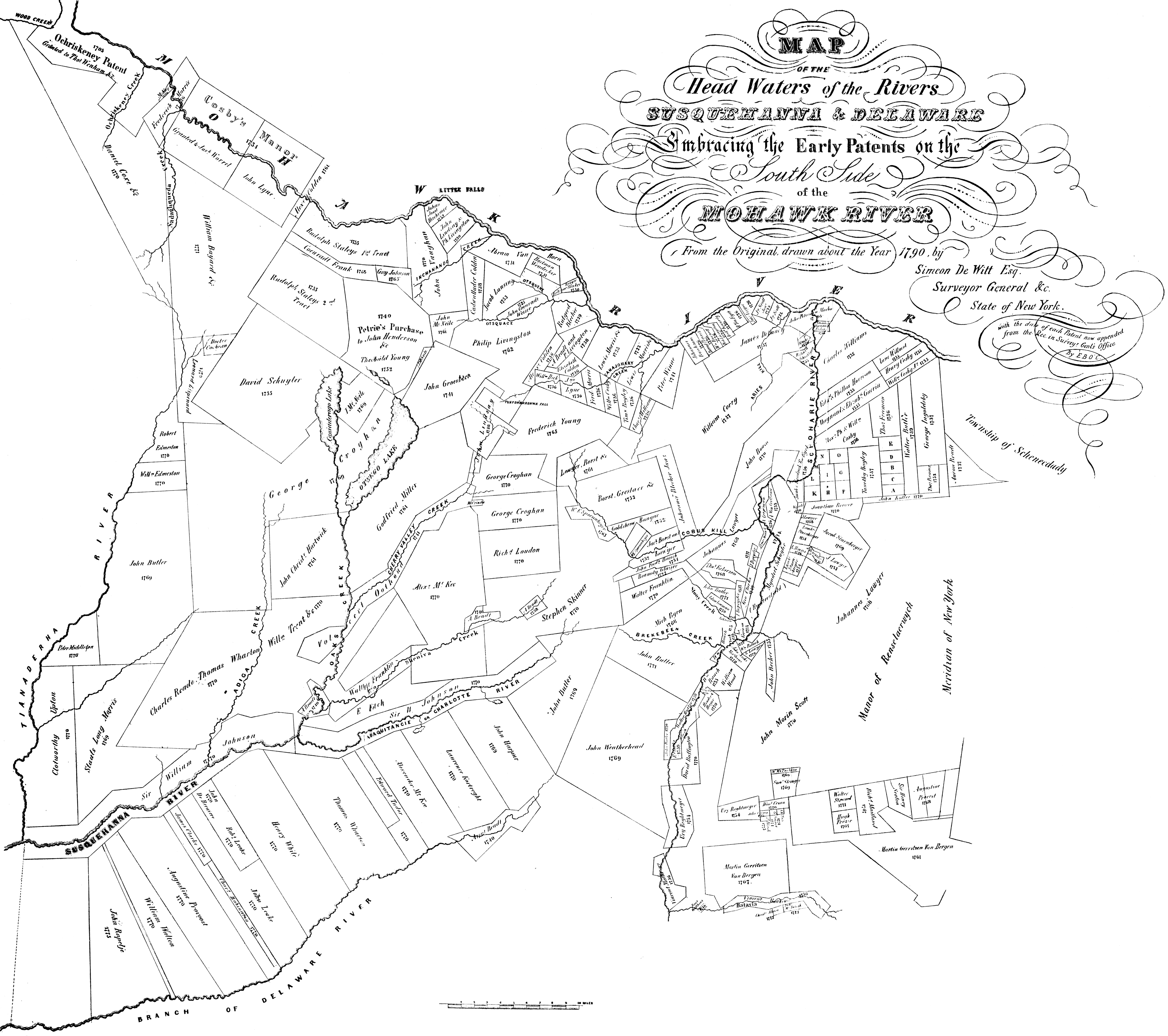
| Description | Map of the Head Waters of the Rivers Susquehanna and Deleware, Embracing the Early Patents on the South Side of the Mohawk River. From the orignal drawn about the year 1790 by Simeon Dewitt Esq., Surveyor General &c. State of New York, with the date of each Patent now appended from the Rec. in Survey'r Gen'l's Office, By EBOC. A foldout map in The Old New York Frontier by Francis Whiting Halsey, published in 1901. | ||||||||||||||||||||
| Date | |||||||||||||||||||||
| Source | Scanned by me from The Old New York Frontier | ||||||||||||||||||||
| Author |
|
||||||||||||||||||||
| Permission (Reusing this file) |
|
||||||||||||||||||||
| Other versions |
|
||||||||||||||||||||

File history
Click on a date/time to view the file as it appeared at that time.
| Date/Time | Thumbnail | Dimensions | User | Comment | |
|---|---|---|---|---|---|
| current | 02:16, 25 May 2007 | | 4,589 × 4,071 (1.77 MB) | Nonenmac (talk | contribs) | |
| 18:30, 18 June 2006 |  | 4,652 × 4,219 (1.83 MB) | Nonenmac (talk | contribs) | {{Information |Description=''Map of the Head Waters of the Rivers Susquehanna and Deleware, Embracing the Early Patents on the South Side of the Mohawk River. From the orignal drawn about the year 1790 by Simeon Dewitt Esq., Surveyor General &c. State of |
You cannot overwrite this file.
File usage on Commons
There are no pages that use this file.