File:Hakken River 1.jpg
Jump to navigation
Jump to search
Size of this preview: 800 × 600 pixels. Other resolutions: 320 × 240 pixels | 640 × 480 pixels | 1,024 × 768 pixels | 1,280 × 960 pixels | 1,600 × 1,200 pixels.
Original file (1,600 × 1,200 pixels, file size: 947 KB, MIME type: image/jpeg)
Captions
Captions
Add a one-line explanation of what this file represents
Summary
[edit]
| Description |
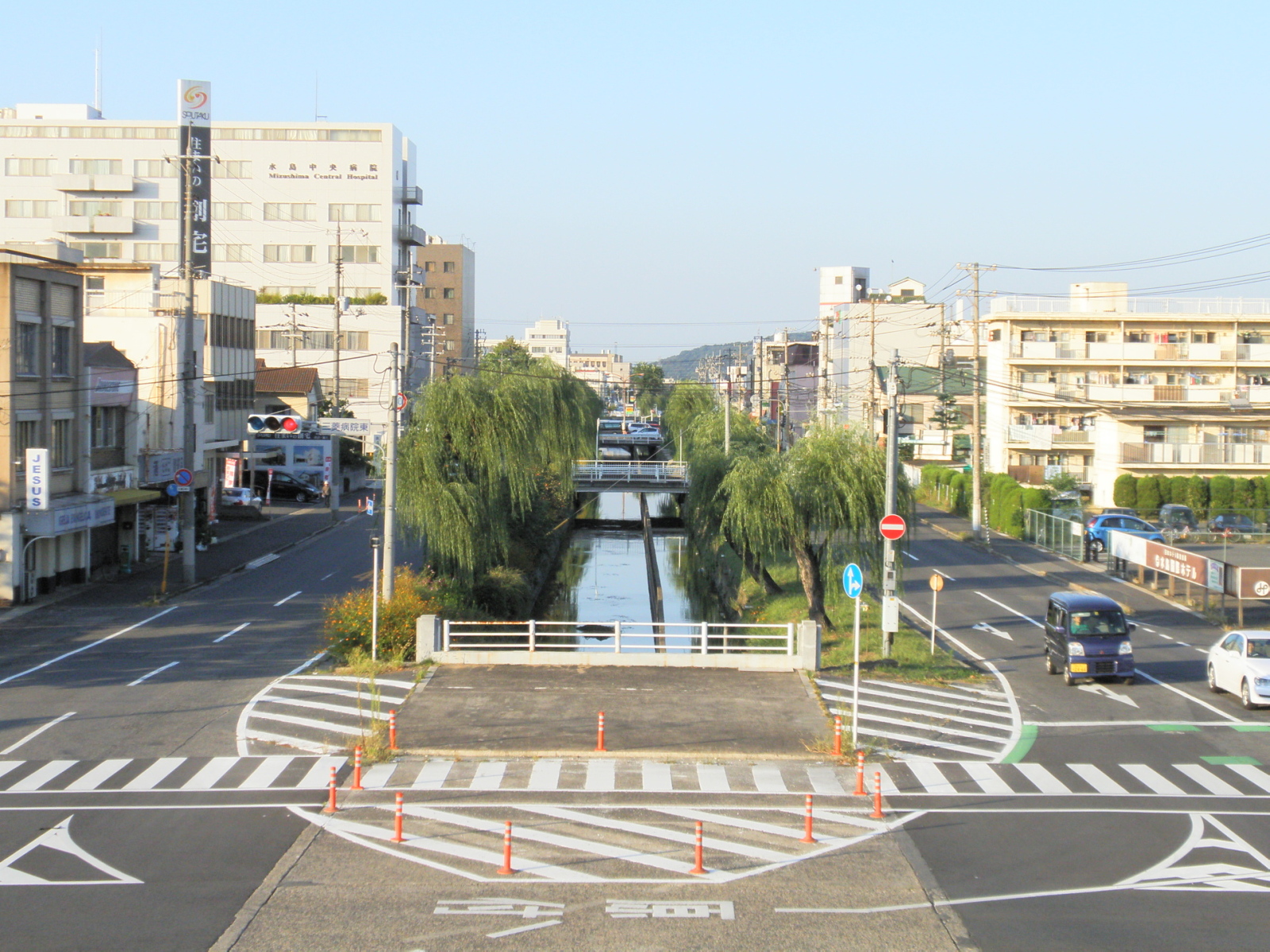
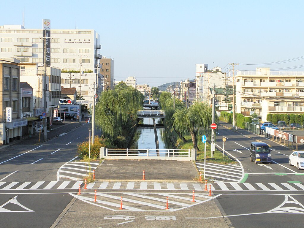
English: Hakken River in Mizushima, Kurashiki, Okayama prefecture 日本語:岡山県倉敷市水島の中心部を流れる旧東高梁川廃川地に掘削された八間川。1953年まではこの川の東側(右側)が児島郡福田町、西側が浅口郡連島町と行政区画の境界になっていた。 |
| Date | |
| Source | Own work |
| Author | Phronimoi |
| Camera location | | View this and other nearby images on: OpenStreetMap |
|---|
Licensing
[edit]
| I, the copyright holder of this work, release this work into the public domain. This applies worldwide. In some countries this may not be legally possible; if so: I grant anyone the right to use this work for any purpose, without any conditions, unless such conditions are required by law. |
File history
Click on a date/time to view the file as it appeared at that time.
| Date/Time | Thumbnail | Dimensions | User | Comment | |
|---|---|---|---|---|---|
| current | 18:30, 25 October 2009 | | 1,600 × 1,200 (947 KB) | Phronimoi (talk | contribs) | {{Information |Description={{ja|1=岡山県倉敷市水島の中心部を流れる旧東高梁川廃川地に掘削された八間川。<br /> 1953年まではこの川の東側(右側)が児島郡福田町、西側が浅口郡連島町と行政区画 |
You cannot overwrite this file.
File usage on Commons
There are no pages that use this file.