File:Haiti, 4.5, 20 May 2010.jpg
Jump to navigation
Jump to search
Size of this preview: 536 × 599 pixels. Other resolutions: 215 × 240 pixels | 612 × 684 pixels.
Original file (612 × 684 pixels, file size: 163 KB, MIME type: image/jpeg)
Captions
Captions
Add a one-line explanation of what this file represents
| Description |
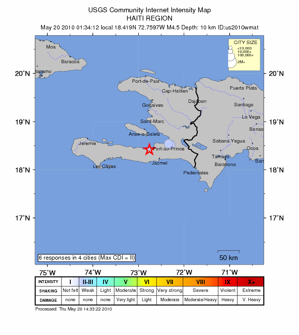
English: Intensity map of an earthquake which occured in Haiti on 20th May 2010. |
|||
| Date | ||||
| Source | https://earthquake.usgs.gov/earthquakes/dyfi/events/us/2010wmat/us/index.html | |||
| Author | USGS | |||
| Permission (Reusing this file) |
|
File history
Click on a date/time to view the file as it appeared at that time.
| Date/Time | Thumbnail | Dimensions | User | Comment | |
|---|---|---|---|---|---|
| current | 15:40, 20 May 2010 | | 612 × 684 (163 KB) | Seksen iki yüz kırk beş (talk | contribs) | {{Information |Description={{en|1=Intensity map of an earthquake which occured in Haiti on 20th May 2010.}} |Source=http://earthquake.usgs.gov/earthquakes/dyfi/events/us/2010wmat/us/index.html |Author=USGS |Date=20th May 2010 |Permission={{PD- |
You cannot overwrite this file.
File usage on Commons
There are no pages that use this file.
File usage on other wikis
The following other wikis use this file:
- Usage on pap.wikipedia.org