File:Haifa Israel Map.png
Jump to navigation
Jump to search
No higher resolution available.
Haifa_Israel_Map.png (285 × 275 pixels, file size: 15 KB, MIME type: image/png)
Captions
Captions
7 Ata (אתא) 24, קרית אתא, Haifa, Israel, 2807000
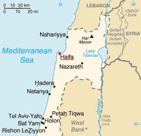
| Description | Haifa on the map of Israel | |||
| Date | ||||
| Source | Image:Is-map.PNG | |||
| Author | PeteCS | |||
| Permission (Reusing this file) |
|

File history
Click on a date/time to view the file as it appeared at that time.
| Date/Time | Thumbnail | Dimensions | User | Comment | |
|---|---|---|---|---|---|
| current | 09:38, 18 February 2007 | | 285 × 275 (15 KB) | PeteCS (talk | contribs) | {{Information |Description=Haifa on the map of Israel |Source=Image:Is-map.PNG |Date=18-02-2007 |Author=~~~ |Permission={{PD-USGov-CIA-WF}} |other_versions=jiné verze }} Category:Haifa |
You cannot overwrite this file.
File usage on Commons
There are no pages that use this file.
File usage on other wikis
The following other wikis use this file: