File:Hagibis 2019-10-09 0105Z.jpg
Jump to navigation
Jump to search
Size of this preview: 439 × 599 pixels. Other resolutions: 176 × 240 pixels | 352 × 480 pixels | 563 × 768 pixels | 751 × 1,024 pixels | 1,501 × 2,048 pixels | 5,856 × 7,987 pixels.
Original file (5,856 × 7,987 pixels, file size: 4.7 MB, MIME type: image/jpeg)
Captions
Captions
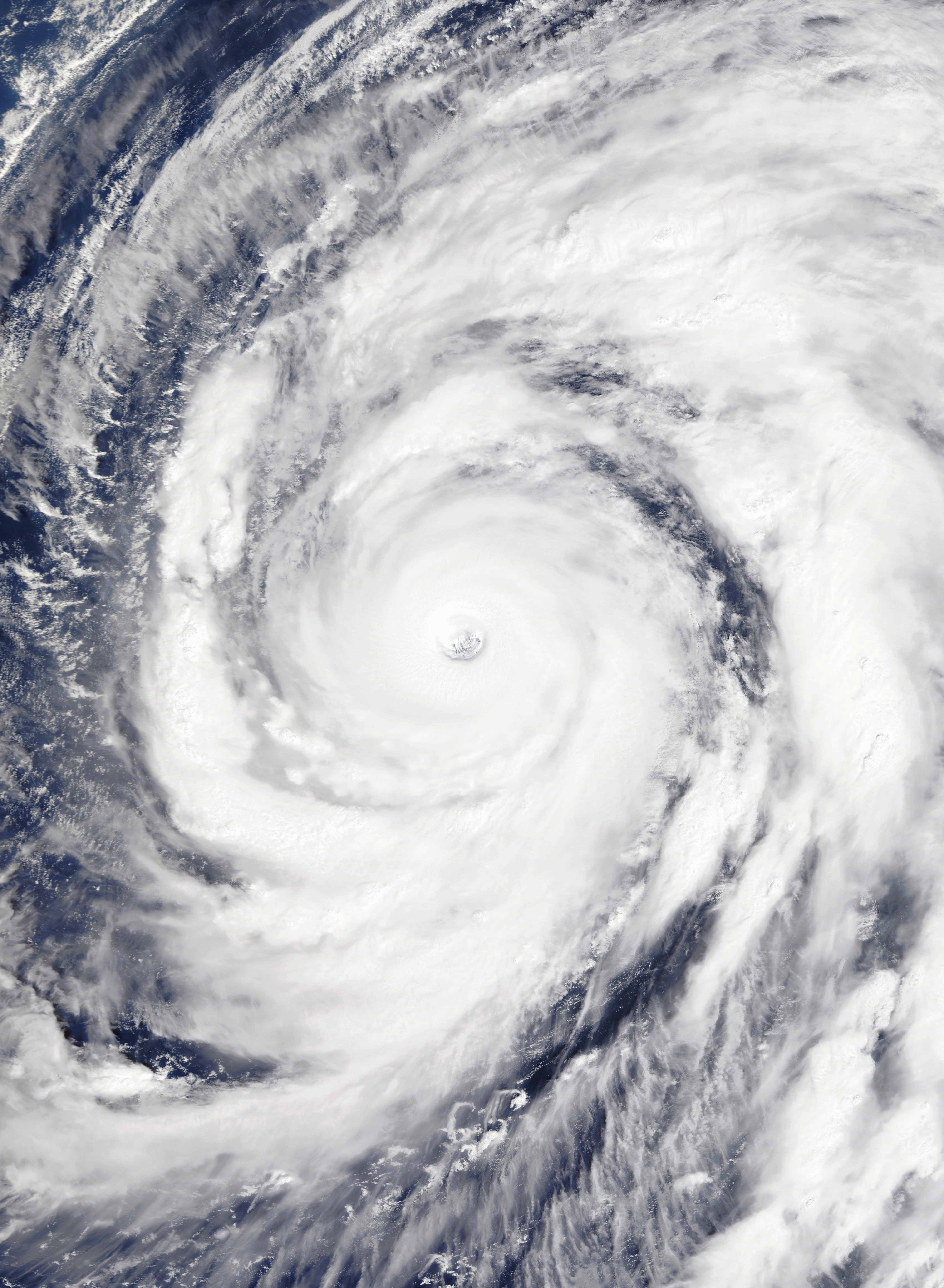
Typhoon Hagibis at peak intensity over the Pacific Ocean on 9 October 2019.
Summary
[edit]
| Description |
English: Typhoon Hagibis at peak intensity over the Pacific Ocean, to the west of the Northern Mariana Islands, on 9 October 2019. 10-minute sustained winds are at 195 km/h (120 mph), and one-minute sustained winds are at 260 km/h (160 mph), making Hagibis an extremely powerful Category 5 super typhoon on the Saffir-Simpson hurricane wind scale. |
| Date | |
| Source | NASA Worldview |
| Author | National Aeronautics and Space Administration (NASA) - 'Terra' satellite |
| Camera location | | View this and other nearby images on: OpenStreetMap |
|---|
Licensing
[edit]
| This file is in the public domain in the United States because it was solely created by NASA. NASA copyright policy states that "NASA material is not protected by copyright unless noted". (See Template:PD-USGov, NASA copyright policy page or JPL Image Use Policy.) | ||
 |
Warnings:
|
File history
Click on a date/time to view the file as it appeared at that time.
| Date/Time | Thumbnail | Dimensions | User | Comment | |
|---|---|---|---|---|---|
| current | 08:38, 9 October 2019 | | 5,856 × 7,987 (4.7 MB) | Nino Marakot (talk | contribs) | Reverted to version as of 04:21, 9 October 2019 (UTC) - Superior i think |
| 08:34, 9 October 2019 |  | 6,080 × 8,000 (2.58 MB) | Nino Marakot (talk | contribs) | Corrected ratio | |
| 04:21, 9 October 2019 |  | 5,856 × 7,987 (4.7 MB) | ChocolateTrain (talk | contribs) | User created page with UploadWizard |
You cannot overwrite this file.
File usage on Commons
The following 2 pages use this file:
- User:Jupiter50
- File:Hagibis 2019-10-09 0107Z.jpg (file redirect)
File usage on other wikis
The following other wikis use this file:
- Usage on en.wikipedia.org