File:HaShfela.svg
Jump to navigation
Jump to search

Size of this PNG preview of this SVG file: 800 × 518 pixels. Other resolutions: 320 × 207 pixels | 640 × 414 pixels | 1,024 × 663 pixels | 1,280 × 829 pixels | 2,560 × 1,658 pixels | 2,100 × 1,360 pixels.
Original file (SVG file, nominally 2,100 × 1,360 pixels, file size: 104 KB)
Captions
Captions
Add a one-line explanation of what this file represents
Summary
[edit]
| Description |
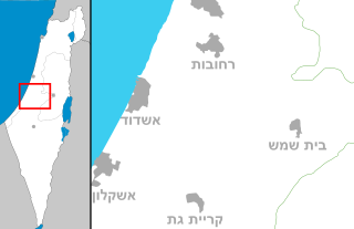
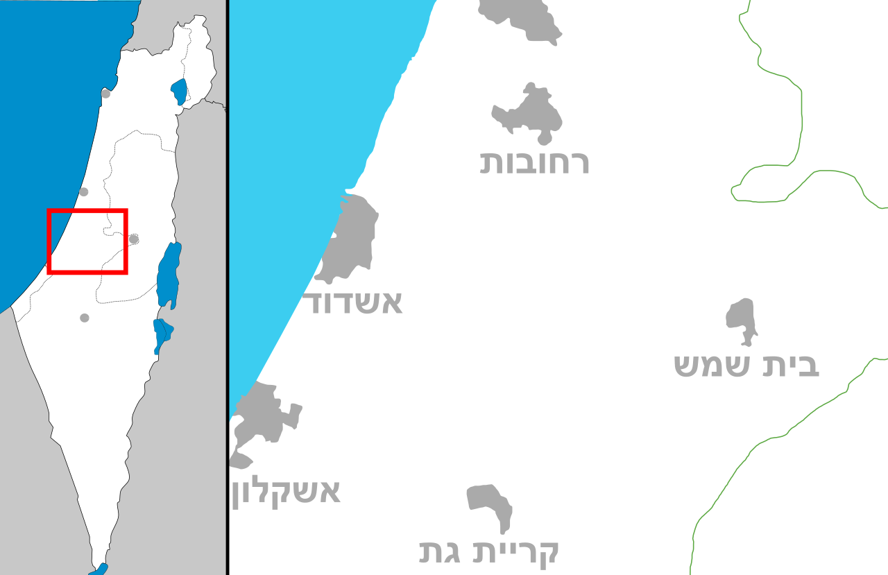
English: Map of HaShfela ("Shephelah"), Region in Israel
מפה של איזור השפלה |
| Date | (UTC) |
| Source | Own work |
| Author | Costello |
Licensing
[edit]
I, the copyright holder of this work, hereby publish it under the following licenses:
This file is licensed under the Creative Commons Attribution-Share Alike 3.0 Unported license.
- You are free:
- to share – to copy, distribute and transmit the work
- to remix – to adapt the work
- Under the following conditions:
- attribution – You must give appropriate credit, provide a link to the license, and indicate if changes were made. You may do so in any reasonable manner, but not in any way that suggests the licensor endorses you or your use.
- share alike – If you remix, transform, or build upon the material, you must distribute your contributions under the same or compatible license as the original.

|
Permission is granted to copy, distribute and/or modify this document under the terms of the GNU Free Documentation License, Version 1.2 or any later version published by the Free Software Foundation; with no Invariant Sections, no Front-Cover Texts, and no Back-Cover Texts. A copy of the license is included in the section entitled GNU Free Documentation License. |
You may select the license of your choice.
File history
Click on a date/time to view the file as it appeared at that time.
| Date/Time | Thumbnail | Dimensions | User | Comment | |
|---|---|---|---|---|---|
| current | 12:49, 23 September 2008 | | 2,100 × 1,360 (104 KB) | Costello (talk | contribs) | {{Information |Description={{en|1=Map of HaShfela (Region in Israel)}} מפה של איזור השפלה |Source=Own work by uploader |Author=Costello |Date=~~~~~ |Permission= |other_versions= }} <!--{{ImageUpload|full}}--> [[Category:S |
You cannot overwrite this file.
File usage on Commons
There are no pages that use this file.
File usage on other wikis
The following other wikis use this file:
- Usage on en.wikipedia.org
- Usage on he.wikipedia.org
- אשדוד
- בית ניר
- גת (קיבוץ)
- הראל (קיבוץ)
- אשקלון
- בית שמש
- קריית גת
- קריית מלאכי
- גדרה
- גן יבנה
- ברכיה (מושב)
- נתיב הל"ה
- גברעם
- נחושה
- חצב (מושב)
- תימורים
- מועצה אזורית חבל יבנה
- עין צורים
- גבעת ישעיהו
- כפר אביב
- בית עזרא
- חפץ חיים (קיבוץ)
- גני טל
- בית גוברין (עיר קדומה)
- מרשה
- גת (עיר פלשתית)
- ישעי
- בניה (מושב)
- אורות (מושב)
- מועצה אזורית גדרות
- נחם
- בני דרום
- צרעה (קיבוץ)
- משואות יצחק
- באר גנים
- כתובת עקרון
- שפלת יהודה
- כפר מנחם
- ישיבת הקיבוץ הדתי עין צורים
- נחל לכיש
- חולות ניצנים
- ישיבת אור עציון
- בית גוברין (קיבוץ)
- גשר עד הלום
- מערת הנטיפים (שורק)
- ניר גלים
- מועצה אזורית מטה יהודה
- ישיבת כרם ביבנה
- בסיס חצור
View more global usage of this file.