File:HUA-135690-Plattegrond van de stad Utrecht met directe omgeving met weergave van wegen en watergangen van het stratenplan en van enkele kerken en pleinen met ges.jpg

Original file (3,839 × 2,969 pixels, file size: 4.61 MB, MIME type: image/jpeg)
Captions
Captions
Summary
[edit]| Description |
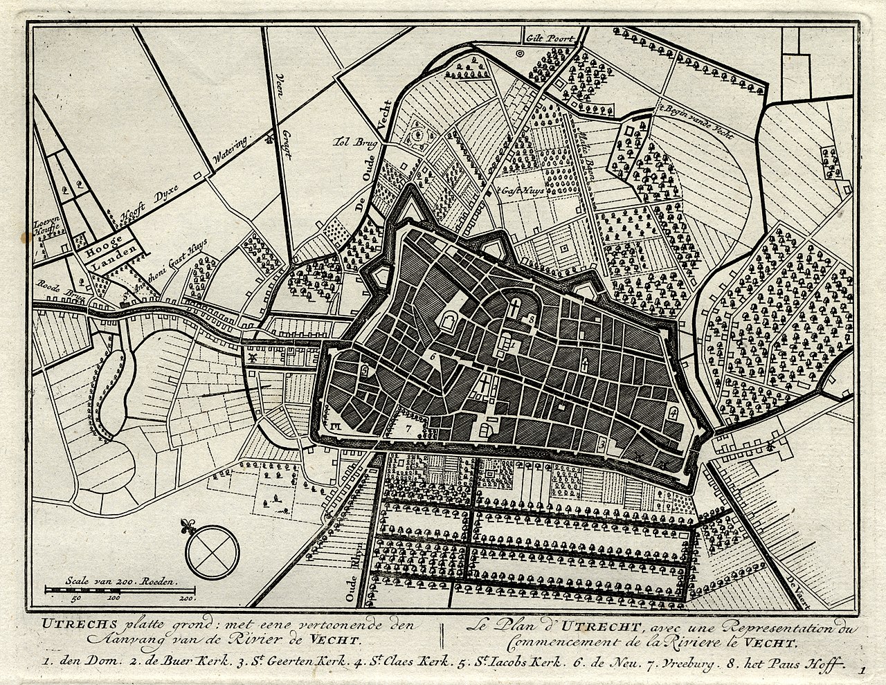
Nederlands: Plattegrond van de stad Utrecht met directe omgeving; met weergave van wegen en watergangen, van het stratenplan en van enkele kerken en pleinen; met gestyleerde weergave van het grondgebruik. |
||||||||||||||||||||
| Date | between 1 January 1718 and 31 December 1719 | ||||||||||||||||||||
| Source | https://hetutrechtsarchief.nl/beeld/18D6F8F14A1957D39039256C17B64D27 | ||||||||||||||||||||
| Geotemporal data | |||||||||||||||||||||
| Scale |
Nederlands: [ca. 1:19000] 300 roeden = 3.8 cm |
||||||||||||||||||||
| Georeferencing | If inappropriate please set warp_status = skip to hide. | ||||||||||||||||||||
| Archival data | |||||||||||||||||||||
| Collection |
|
||||||||||||||||||||
| Accession number |
GUID: 18D6F8F14A1957D39039256C17B64D27, HUA Catalogusnummer: 135690 |
||||||||||||||||||||
| Dimensions | height: 207 cm (81.4 in); width: 246 cm (96.8 in) | ||||||||||||||||||||
| Medium |
Nederlands: ets |
||||||||||||||||||||
| Inscriptions |
Nederlands: Boven: "UTRECHS platte grond: met eene vertoonende den / Aanvang van de Rivier de VECHT. // Le Plan d' UTRECHT, avec une Representation du / Commencement de la Riviere le VECHT. // 1. den Dom. 2. de Buer Kerk. 3. St. Geerten Kerk. 4. St. Claes Kerk. 5. St. Jacobs Kerk. 6. de Neu. 7. Vreeburg. 8. het Paus Hoff." |
||||||||||||||||||||
| Notes |
Nederlands: Plattegrond van de stad Utrecht. Bovenste van twee prenten op één blad in de gebonden prentenreeks 'De Vechtstroom van Utrecht tot Muiden' (nrs. 135688-135789; verzameling 120), uitgegeven in 1791. De uitgave is beschreven bij nummer 135688. Dit is een heruitgave van De Zegepraalende Vecht, uitgegeven in 1719 De kaart is ook beschreven onder nr. 212092. |
||||||||||||||||||||

Licensing
[edit]
|
This work is in the public domain in its country of origin and other countries and areas where the copyright term is the author's life plus 70 years or fewer.
| |
| This file has been identified as being free of known restrictions under copyright law, including all related and neighboring rights. | |
This media file is from the collections of the Het Utrechts Archief. This tag does not indicate the copyright status of the attached work. A normal copyright tag is still required. See Commons:Licensing.
|
File history
Click on a date/time to view the file as it appeared at that time.
| Date/Time | Thumbnail | Dimensions | User | Comment | |
|---|---|---|---|---|---|
| current | 16:49, 15 February 2021 | | 3,839 × 2,969 (4.61 MB) | CompanjeBot (talk | contribs) | Uploading image from Het Utrechts Archief: https://hetutrechtsarchief.nl/beeld/18D6F8F14A1957D39039256C17B64D27 |
You cannot overwrite this file.
File usage on Commons
There are no pages that use this file.