File:Guy homestead.jpg
Jump to navigation
Jump to search

Size of this preview: 800 × 497 pixels. Other resolutions: 320 × 199 pixels | 640 × 397 pixels | 1,024 × 636 pixels | 1,280 × 795 pixels | 2,762 × 1,715 pixels.
Original file (2,762 × 1,715 pixels, file size: 903 KB, MIME type: image/jpeg)
Captions
Captions
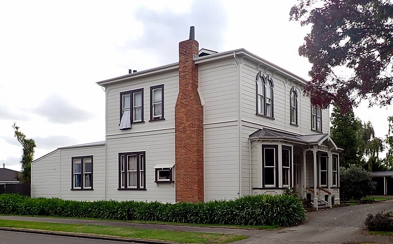
Guy homestead, Palmerston North, New Zealand
Summary
[edit]
| Description |
English: Built in 1893 on ten acres of land at 145 Rangitikei Street. In 1903 it was bought by Andrew Guy, a local barrister and solicitor. The Guy estate was subdivided in 1935, to form Guy Avenue and the house remained on one section of the original property. It is listed in Category II of the City Register of Historic Buildings. |
| Date | |
| Source | Own work |
| Author | Mike Dickison |
| Camera location | | View this and other nearby images on: OpenStreetMap |
|---|
Licensing
[edit]
I, the copyright holder of this work, hereby publish it under the following license:
This file is licensed under the Creative Commons Attribution 4.0 International license.
- You are free:
- to share – to copy, distribute and transmit the work
- to remix – to adapt the work
- Under the following conditions:
- attribution – You must give appropriate credit, provide a link to the license, and indicate if changes were made. You may do so in any reasonable manner, but not in any way that suggests the licensor endorses you or your use.
File history
Click on a date/time to view the file as it appeared at that time.
| Date/Time | Thumbnail | Dimensions | User | Comment | |
|---|---|---|---|---|---|
| current | 01:34, 12 April 2020 | | 2,762 × 1,715 (903 KB) | Giantflightlessbirds (talk | contribs) | Uploaded own work with UploadWizard |
You cannot overwrite this file.
File usage on Commons
There are no pages that use this file.
File usage on other wikis
The following other wikis use this file:
- Usage on de.wikipedia.org
- Usage on www.wikidata.org