File:Gutachtal.jpg
Jump to navigation
Jump to search
Size of this preview: 800 × 509 pixels. Other resolutions: 320 × 204 pixels | 640 × 407 pixels | 1,037 × 660 pixels.
Original file (1,037 × 660 pixels, file size: 91 KB, MIME type: image/jpeg)
Captions
Captions
Add a one-line explanation of what this file represents
Summary
[edit]| Description |
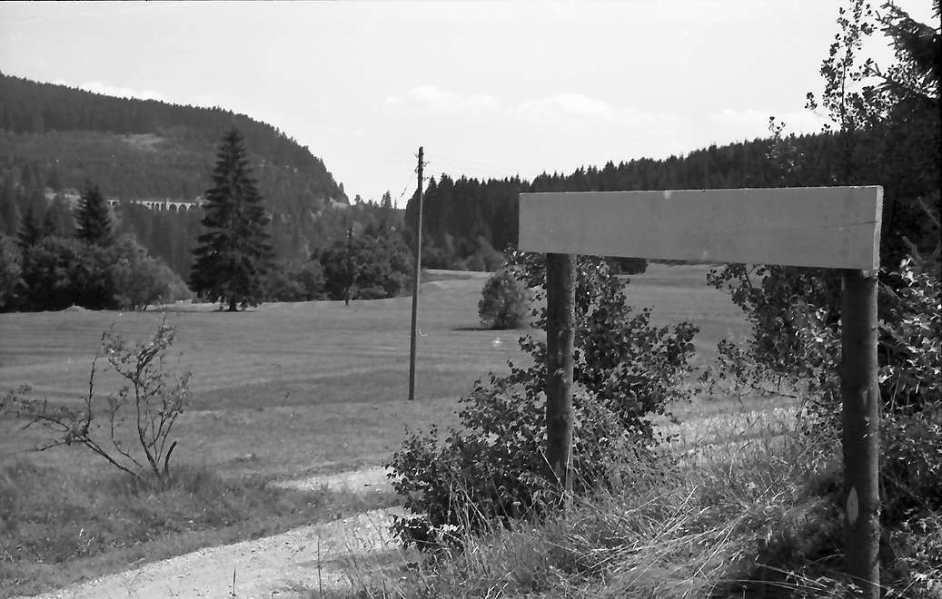
Deutsch: Gutachtal bei Kappel mit Blickrichtung Hörnle. Überflutungsbereich durch den geplanten Wutach-Haslach Stausee. Im Vordergrung Markierung der max. Stauhöhe. (780 m. NN). Im Hintergrund die Schwendeholzdobelbrücke der östlichen Höllentalbahn sowie die Stromleitung zur Zipfelsäge. |
|||||||||||||||||||||||
| Date | ||||||||||||||||||||||||
| Source | Staatsarchiv Freiburg W 134 Nr. 023381a | |||||||||||||||||||||||
| Author |
|
|||||||||||||||||||||||
| Permission (Reusing this file) |
Nutzungsbedingungen für Inhalte und Digitalisate auf den Webseiten des Landesarchivs | |||||||||||||||||||||||
,_Bukarest_034022a.jpg)
| Camera location | | View this and other nearby images on: OpenStreetMap |
|---|
Licensing
[edit]
This file is licensed under the Creative Commons Attribution 3.0 Germany license.
Attribution: Landesarchiv Baden-Württemberg, Fotograf: Willy Pragher
- You are free:
- to share – to copy, distribute and transmit the work
- to remix – to adapt the work
- Under the following conditions:
- attribution – You must give appropriate credit, provide a link to the license, and indicate if changes were made. You may do so in any reasonable manner, but not in any way that suggests the licensor endorses you or your use.

File history
Click on a date/time to view the file as it appeared at that time.
| Date/Time | Thumbnail | Dimensions | User | Comment | |
|---|---|---|---|---|---|
| current | 11:21, 23 March 2017 | | 1,037 × 660 (91 KB) | Flominator (talk | contribs) | http://www.leo-bw.de/media/labw_findmittel/current/delivered/bilder/labw-5-370832-1.jpg |
| 11:20, 23 March 2017 |  | 988 × 659 (84 KB) | Flominator (talk | contribs) | Cropped 5 % horizontally and 26 % vertically using CropTool with precise mode. | |
| 11:51, 28 December 2016 |  | 1,037 × 887 (120 KB) | Spitzkehre (talk | contribs) | {{Information |Description ={{de|1=Gutachtal bei Kappel. Überflutungsbereich durch den geplanten Wutach-Haslach Stausee. Im Vordergrung Markierung der max. Stauhöhe.}} |Source =http://www.landesarchiv-bw.de/plink/?f=5-370832 |Author... |
You cannot overwrite this file.
File usage on Commons
The following 3 pages use this file:
File usage on other wikis
The following other wikis use this file:
- Usage on de.wikipedia.org