File:Gunnislake old railway station (geograph 3854329).jpg
Jump to navigation
Jump to search

Size of this preview: 800 × 533 pixels. Other resolutions: 320 × 213 pixels | 640 × 426 pixels | 1,024 × 682 pixels | 1,280 × 853 pixels | 1,600 × 1,066 pixels.
Original file (1,600 × 1,066 pixels, file size: 284 KB, MIME type: image/jpeg)
Captions
Captions
Add a one-line explanation of what this file represents
Summary
[edit].jpg&action=edit§ion=1)
| Description |
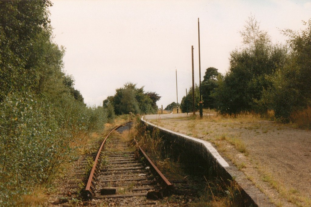
English: Gunnislake old railway station This is the original railway station at Gunnislake, which at the time this photograph was taken had just been replaced by a shiny new station on the other side of the road, allowing the demolition of a low bridge. Originally, Gunnislake was on the branch to Callington, but became a terminus in 1966 when the line from Gunnislake to Callington was closed. This area is all houses now and completely unrecognisable. |
| Date | |
| Source | From geograph.org.uk |
| Author | John Winder |
| Permission (Reusing this file) |
Creative Commons Attribution Share-alike license 2.0 |
| Attribution (required by the license) | John Winder / Gunnislake old railway station / |
| Camera location | | View this and other nearby images on: OpenStreetMap |
|---|
.jpg¶ms=050.517864_N_-004.220195_E_globe:Earth_type:camera_source:geograph-osgb36(SX42707103)_heading:157.00&language=en)
| Object location | | View this and other nearby images on: OpenStreetMap |
|---|
.jpg¶ms=050.517600_N_-004.219900_E_globe:Earth_class:object_type:object_source:geograph-osgb36(SX42727100)_heading:157.00&language=en)
Licensing
[edit].jpg&action=edit§ion=2)

|
This image was taken from the Geograph project collection. See this photograph's page on the Geograph website for the photographer's contact details. The copyright on this image is owned by John Winder and is licensed for reuse under the Creative Commons Attribution-ShareAlike 2.0 license.
|
This file is licensed under the Creative Commons Attribution-Share Alike 2.0 Generic license.
Attribution: John Winder
- You are free:
- to share – to copy, distribute and transmit the work
- to remix – to adapt the work
- Under the following conditions:
- attribution – You must give appropriate credit, provide a link to the license, and indicate if changes were made. You may do so in any reasonable manner, but not in any way that suggests the licensor endorses you or your use.
- share alike – If you remix, transform, or build upon the material, you must distribute your contributions under the same or compatible license as the original.
File history
Click on a date/time to view the file as it appeared at that time.
| Date/Time | Thumbnail | Dimensions | User | Comment | |
|---|---|---|---|---|---|
| current | 22:58, 2 November 2020 | | 1,600 × 1,066 (284 KB) | Lamberhurst (talk | contribs) | Transferred from geograph.co.uk using [https://tools.wmflabs.org/geograph2commons/ geograph2commons] |
You cannot overwrite this file.
File usage on Commons
The following page uses this file:
.jpg&oldid=549331730)