File:Guisborough geograph-3696257-by-Ben-Brooksbank.jpg
Jump to navigation
Jump to search

Size of this preview: 800 × 503 pixels. Other resolutions: 320 × 201 pixels | 640 × 402 pixels | 1,024 × 644 pixels | 1,280 × 805 pixels | 2,371 × 1,491 pixels.
Original file (2,371 × 1,491 pixels, file size: 2.92 MB, MIME type: image/jpeg)
Captions
Captions
Add a one-line explanation of what this file represents
Summary
[edit]
| Description |
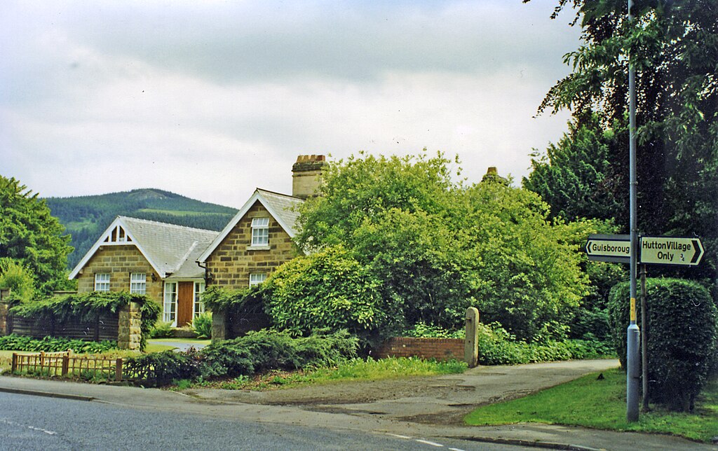
English: Hutton Lane, near site of Hutton Gate station. View SE to the edge of the Cleveland Hills (Cod Hill, 1,024 ft.). The station had been in the trees on the right and was on the ex-NER line from Middlesbrough to Guisborough, Brotton, Loftus, Whitby and Scarborough. The station had been closed 2/3/53, but a passenger service (Middlesbrough - Guisborough - Loftus only) continued until 2/5/60 and the line remained open for freight until 2/3/64 |
| Date | |
| Source | From geograph.org.uk |
| Author | Ben Brooksbank |
| Permission (Reusing this file) |
Creative Commons Attribution Share-alike license 2.0 |
| Attribution (required by the license) | Ben Brooksbank / Hutton Lane, near site of Hutton Gate station / |
| Camera location | | View this and other nearby images on: OpenStreetMap |
|---|
Licensing
[edit]

|
This image was taken from the Geograph project collection. See this photograph's page on the Geograph website for the photographer's contact details. The copyright on this image is owned by Ben Brooksbank and is licensed for reuse under the Creative Commons Attribution-ShareAlike 2.0 license.
|
This file is licensed under the Creative Commons Attribution-Share Alike 2.0 Generic license.
Attribution: Ben Brooksbank
- You are free:
- to share – to copy, distribute and transmit the work
- to remix – to adapt the work
- Under the following conditions:
- attribution – You must give appropriate credit, provide a link to the license, and indicate if changes were made. You may do so in any reasonable manner, but not in any way that suggests the licensor endorses you or your use.
- share alike – If you remix, transform, or build upon the material, you must distribute your contributions under the same or compatible license as the original.
File history
Click on a date/time to view the file as it appeared at that time.
| Date/Time | Thumbnail | Dimensions | User | Comment | |
|---|---|---|---|---|---|
| current | 09:19, 2 November 2013 | | 2,371 × 1,491 (2.92 MB) | Chevin (talk | contribs) | == {{int:filedesc}} == {{Information |Description={{en|1='''Hutton Lane, near site of Hutton Gate station.'''<br/> View SE to the edge of the Cleveland Hills (Cod Hill, 1,024 ft.). The station had been in the trees on the right and was on the ex-NER li... |
You cannot overwrite this file.
File usage on Commons
The following page uses this file: