File:Guinea CIA map PL.png
Jump to navigation
Jump to search
No higher resolution available.
Guinea_CIA_map_PL.png (330 × 355 pixels, file size: 11 KB, MIME type: image/png)
Captions
Captions
Add a one-line explanation of what this file represents
| Description |
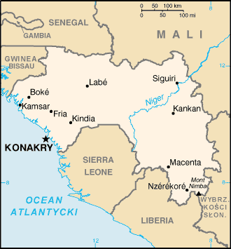
Polski: Mapa Gwinei na podstawie CIA World Factbook |
| Source | CIA World Fact Book |
| Author | CIA |
Licensing
[edit]
This image is in the public domain because it contains materials that originally came from the United States Central Intelligence Agency's World Factbook.
|
 |
Original upload log
[edit]
The original description page was here. All following user names refer to pl.wikipedia.
- 2005-09-16 22:41 Zero 330×355× (11020 bytes) Mapa Gwinei na podstawie CIA World Factbook. Zmiany własne. {{GFDL}}
File history
Click on a date/time to view the file as it appeared at that time.
| Date/Time | Thumbnail | Dimensions | User | Comment | |
|---|---|---|---|---|---|
| current | 10:33, 14 January 2010 | | 330 × 355 (11 KB) | File Upload Bot (Magnus Manske) (talk | contribs) | {{BotMoveToCommons|pl.wikipedia|year={{subst:CURRENTYEAR}}|month={{subst:CURRENTMONTHNAME}}|day={{subst:CURRENTDAY}}}} {{Information |Description={{pl|Mapa Gwinei na podstawie CIA World Factbook. Zmiany własne.}} |Source=Transferred from [http://pl.wiki |
You cannot overwrite this file.
File usage on Commons
There are no pages that use this file.
File usage on other wikis
The following other wikis use this file:
- Usage on ca.wikipedia.org
- Usage on ff.wikipedia.org
- Usage on pl.wikipedia.org