File:Guillaume Delisle, Tabula Geographica provinciarum et Urbium Coloniâ Romanâ vel Municipii jure vel aliâ quâvis praerogativâ insignium (FL158893378 2749727).jpg
Jump to navigation
Jump to search

Size of this preview: 786 × 600 pixels. Other resolutions: 315 × 240 pixels | 629 × 480 pixels | 1,006 × 768 pixels | 1,280 × 977 pixels | 2,560 × 1,954 pixels | 16,436 × 12,545 pixels.
Original file (16,436 × 12,545 pixels, file size: 189.68 MB, MIME type: image/jpeg)
Captions
Captions
Add a one-line explanation of what this file represents
Summary
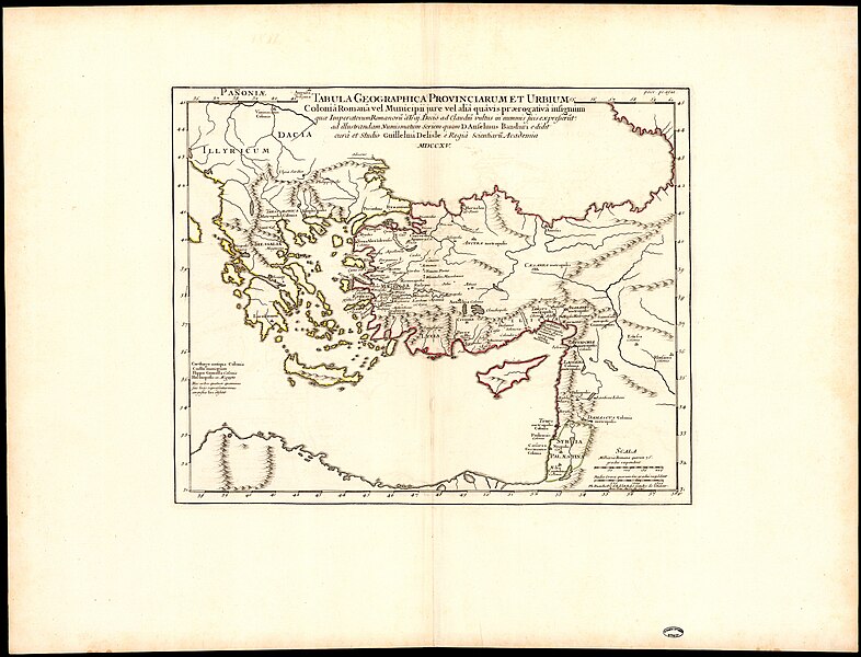
[edit]| Guillaume Delisle: Tabula Geographica provinciarum et Urbium Coloniâ Romanâ vel Municipii jure vel aliâ quâvis praerogativâ insignium
( |
||||||||||||||||||||||||
|---|---|---|---|---|---|---|---|---|---|---|---|---|---|---|---|---|---|---|---|---|---|---|---|---|
| Artist |
| |||||||||||||||||||||||
| Contributors | Banduri, Anselmo Maria, 1675-1743 | |||||||||||||||||||||||
| Title |
Tabula Geographica provinciarum et Urbium Coloniâ Romanâ vel Municipii jure vel aliâ quâvis praerogativâ insignium |
|||||||||||||||||||||||
| Description |
Tabula Geographica provinciarum et Urbium Coloniâ Romanâ vel Municipii jure vel aliâ quâvis praerogativâ insignium. ad illustrandam Numismatum Seriem quam D Amselmus Banduri edidit curâ et Studio Guillelmi Delisle. |
|||||||||||||||||||||||
| Language | Latin | |||||||||||||||||||||||
| Publication date | 1715 | |||||||||||||||||||||||
| Medium | 1 map : col ; | |||||||||||||||||||||||
| Dimensions | height: 34 cm (13.3 in); width: 42 cm (16.5 in) | |||||||||||||||||||||||
| Collection |
|
|||||||||||||||||||||||
| Current location |
|
|||||||||||||||||||||||
| Place of publication | unknown | |||||||||||||||||||||||
| search Merhav catalog | unknown | |||||||||||||||||||||||
| Notes | ||||||||||||||||||||||||
| IE PID | IE158893376 | |||||||||||||||||||||||
| Rosetta filename | FL158893378 | |||||||||||||||||||||||
| NNL item ID (P3959) | 990027497270205171 | |||||||||||||||||||||||
| search Merhav catalog | Latin, Guillaume Delisle | |||||||||||||||||||||||
| search Merhav catalog | History, AncientMaps | |||||||||||||||||||||||
| Source/Photographer |
|
|||||||||||||||||||||||
| Other versions | ||||||||||||||||||||||||
| Jpg / Tif version |
|
|||||||||||||||||||||||


.jpg)

.jpg&action=edit§ion=1)
Licensing
[edit].jpg&action=edit§ion=2)
The copyright situation of this work is theoretically uncertain, because in the country of origin copyright lasts 70 years after the death of the author, and the date of the author's death is unknown. However, the date of creation of the work was over 120 years ago, and it is thus a reasonable assumption that the copyright has expired (see here for the community discussion). Do not use this template if the date of death of the author is known.
| |
| This file has been identified as being free of known restrictions under copyright law, including all related and neighboring rights. | |
File history
Click on a date/time to view the file as it appeared at that time.
| Date/Time | Thumbnail | Dimensions | User | Comment | |
|---|---|---|---|---|---|
| current | 22:40, 9 August 2023 | | 16,436 × 12,545 (189.68 MB) | Geagea (talk | contribs) | pattypan 22.03 |
You cannot overwrite this file.
File usage on Commons
The following 2 pages use this file:
.jpg&oldid=817948823)