File:Grossbeeren Pyramide.jpg
Jump to navigation
Jump to search

Size of this preview: 525 × 600 pixels. Other resolutions: 210 × 240 pixels | 420 × 480 pixels | 672 × 768 pixels | 896 × 1,024 pixels | 1,470 × 1,680 pixels.
Original file (1,470 × 1,680 pixels, file size: 381 KB, MIME type: image/jpeg)
Captions
Captions
Add a one-line explanation of what this file represents
Summary
[edit]
| Camera location | | View this and other nearby images on: OpenStreetMap |
|---|
| Description |
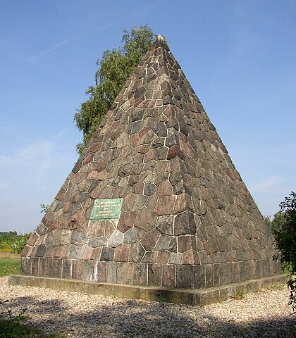
Deutsch: Pyramide zur Erinnerung an die siegreiche Schlacht bei Großbeeren in Brandenburg, Deutschland |
| Date | |
| Source | Own work |
| Author | Doris Antony, Berlin |
| Permission (Reusing this file) |
Doris Antony put it under the GFDL and CC-BY-SA-3.0 |
| Openstreetmap entry | Link to Openstreetmap |
| Object location | | View this and other nearby images on: OpenStreetMap |
|---|
Licensing
[edit]
I, the copyright holder of this work, hereby publish it under the following licenses:

|
Permission is granted to copy, distribute and/or modify this document under the terms of the GNU Free Documentation License, Version 1.2 or any later version published by the Free Software Foundation; with no Invariant Sections, no Front-Cover Texts, and no Back-Cover Texts. A copy of the license is included in the section entitled GNU Free Documentation License. |
This file is licensed under the Creative Commons Attribution-Share Alike 3.0 Unported, 2.5 Generic, 2.0 Generic and 1.0 Generic license.
- You are free:
- to share – to copy, distribute and transmit the work
- to remix – to adapt the work
- Under the following conditions:
- attribution – You must give appropriate credit, provide a link to the license, and indicate if changes were made. You may do so in any reasonable manner, but not in any way that suggests the licensor endorses you or your use.
- share alike – If you remix, transform, or build upon the material, you must distribute your contributions under the same or compatible license as the original.
You may select the license of your choice.
File history
Click on a date/time to view the file as it appeared at that time.
| Date/Time | Thumbnail | Dimensions | User | Comment | |
|---|---|---|---|---|---|
| current | 14:28, 3 October 2008 | | 1,470 × 1,680 (381 KB) | DorisAntony (talk | contribs) | {{Information| |Description={{en|Memorial of the Battle of Großbeeren in Brandenburg, Germany}}{{de|Pyramide zur Erinnerung an die siegreiche Schlacht bei Großbeeren in [ |
You cannot overwrite this file.
File usage on Commons
The following 2 pages use this file:
File usage on other wikis
The following other wikis use this file:
- Usage on de.wikipedia.org
- Usage on ja.wikipedia.org
- Usage on kbp.wikipedia.org
- Usage on uk.wikipedia.org