File:Grindley geograph-3583314-by-Ben-Brooksbank.jpg
Jump to navigation
Jump to search
Size of this preview: 800 × 503 pixels. Other resolutions: 320 × 201 pixels | 640 × 402 pixels | 1,024 × 643 pixels | 1,280 × 804 pixels | 2,340 × 1,470 pixels.
Original file (2,340 × 1,470 pixels, file size: 3 MB, MIME type: image/jpeg)
Captions
Captions
Add a one-line explanation of what this file represents
Summary
[edit]
| Description |
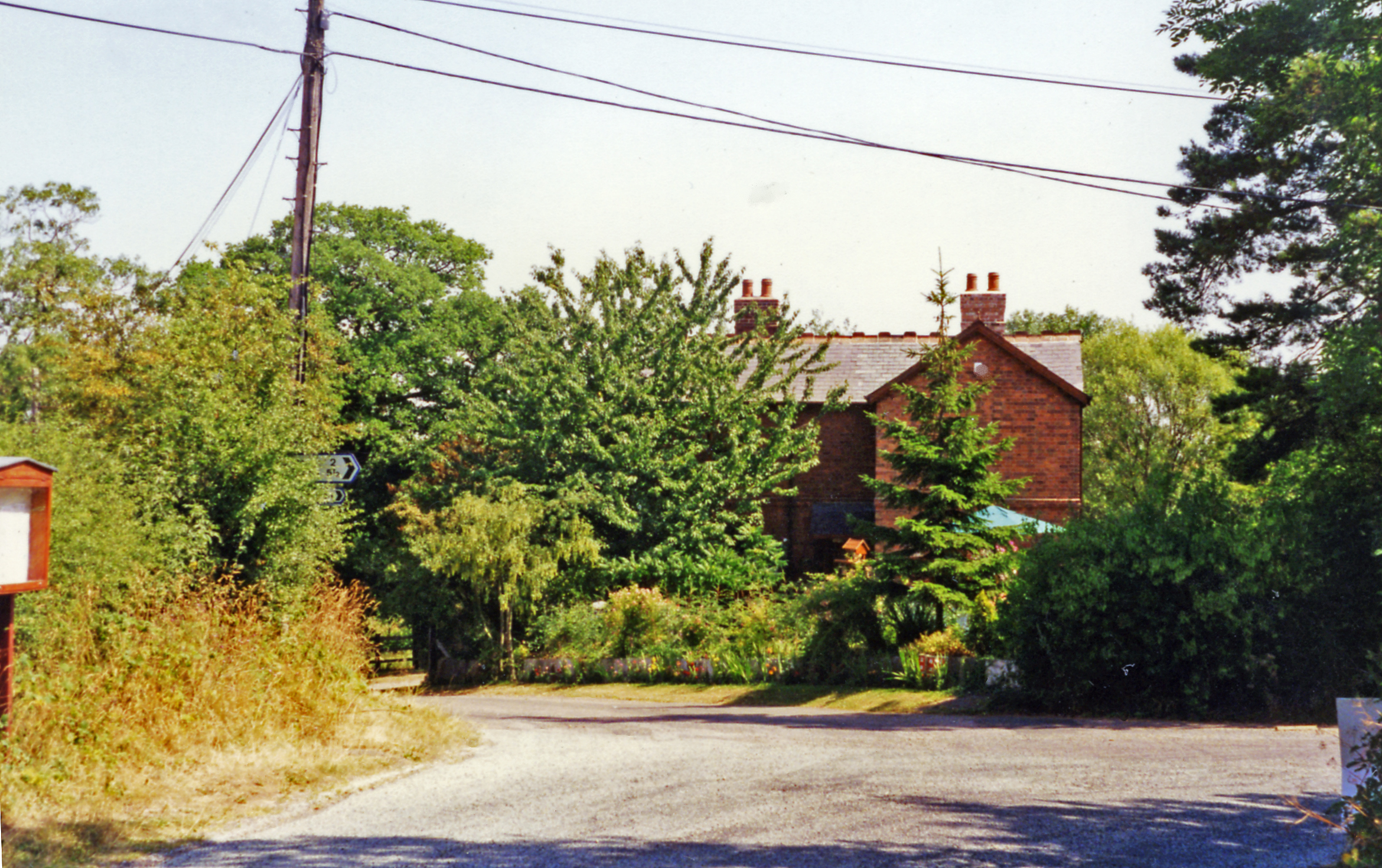
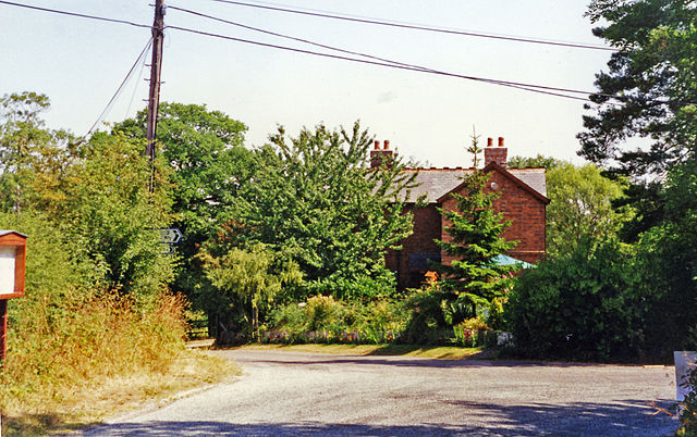
English: Grindley: approximate site of former station, 1995. View eastward, towards Uttoxeter, at the estimated site of Grindley station on the course of the former ex-GNR Uttoxeter - Stafford branch, all closed to goods since 5/3/51, to passengers even from 5/12/39. This outlier of the GNR system came from Nottingham, Derby and Egginton Junction, thence by running powers over the North Stafford line to Uttoxeter. The house seen here might or might not have been the station. |
| Date | |
| Source | From geograph.org.uk |
| Author | Ben Brooksbank |
| Permission (Reusing this file) |
Creative Commons Attribution Share-alike license 2.0 |
| Attribution (required by the license) | Ben Brooksbank / Grindley: approximate site of former station, 1995 / |
| Camera location | | View this and other nearby images on: OpenStreetMap |
|---|
Licensing
[edit]

|
This image was taken from the Geograph project collection. See this photograph's page on the Geograph website for the photographer's contact details. The copyright on this image is owned by Ben Brooksbank and is licensed for reuse under the Creative Commons Attribution-ShareAlike 2.0 license.
|
This file is licensed under the Creative Commons Attribution-Share Alike 2.0 Generic license.
Attribution: Ben Brooksbank
- You are free:
- to share – to copy, distribute and transmit the work
- to remix – to adapt the work
- Under the following conditions:
- attribution – You must give appropriate credit, provide a link to the license, and indicate if changes were made. You may do so in any reasonable manner, but not in any way that suggests the licensor endorses you or your use.
- share alike – If you remix, transform, or build upon the material, you must distribute your contributions under the same or compatible license as the original.
File history
Click on a date/time to view the file as it appeared at that time.
| Date/Time | Thumbnail | Dimensions | User | Comment | |
|---|---|---|---|---|---|
| current | 09:59, 31 August 2013 | | 2,340 × 1,470 (3 MB) | Chevin (talk | contribs) | == {{int:filedesc}} == {{Information |Description={{en|1='''Grindley: approximate site of former station, 1995.'''<br/> View eastward, towards Uttoxeter, at the estimated site of Grindley station on the course of the former ex-GNR Uttoxeter - Stafford ... |
You cannot overwrite this file.
File usage on Commons
There are no pages that use this file.